You are here: Home > Network List > TA - USArray Transportable Network (new EarthScope stations) Stations List
> Station M18A Lyman, WY, USA > Earthquake Result Viewer
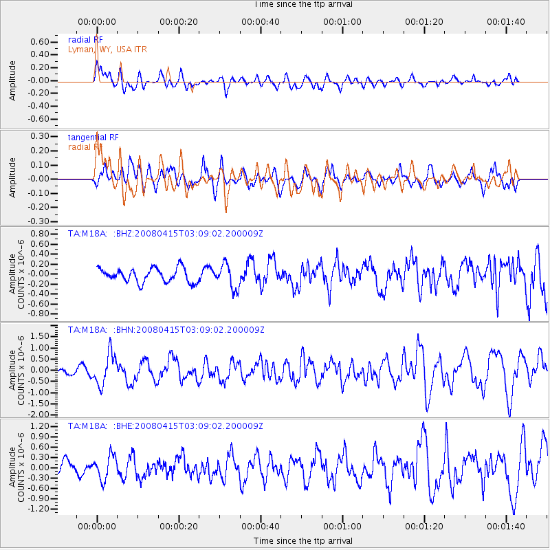
M18A Lyman, WY, USA - Earthquake Result Viewer
*The percent match for this event was below the threshold and hence no stack was calculated.
| Earthquake location: |
Near Coast Of Guatemala |
| Earthquake latitude/longitude: |
13.6/-90.6 |
| Earthquake time(UTC): |
2008/04/15 (106) 03:03:04 GMT |
| Earthquake Depth: |
33 km |
| Earthquake Magnitude: |
5.6 MB, 5.8 MS, 6.1 MW, 6.1 MW |
| Earthquake Catalog/Contributor: |
WHDF/NEIC |
|
| Network: |
TA USArray Transportable Network (new EarthScope stations) |
| Station: |
M18A Lyman, WY, USA |
| Lat/Lon: |
41.43 N/110.07 W |
| Elevation: |
2103 m |
|
| Distance: |
32.5 deg |
| Az: |
332.221 deg |
| Baz: |
142.936 deg |
| Ray Param: |
$rayparam |
*The percent match for this event was below the threshold and hence was not used in the summary stack. |
|
| Radial Match: |
66.11682 % |
| Radial Bump: |
400 |
| Transverse Match: |
61.96887 % |
| Transverse Bump: |
400 |
| SOD ConfigId: |
2504 |
| Insert Time: |
2010-03-06 06:18:51.845 +0000 |
| GWidth: |
2.5 |
| Max Bumps: |
400 |
| Tol: |
0.001 |
|
Signal To Noise
| Channel | StoN | STA | LTA |
| TA:M18A: :BHN:20080415T03:09:02.200009Z | 3.6688483 | 7.2154927E-7 | 1.9666915E-7 |
| TA:M18A: :BHE:20080415T03:09:02.200009Z | 1.9104686 | 3.54164E-7 | 1.853807E-7 |
| TA:M18A: :BHZ:20080415T03:09:02.200009Z | 1.7914957 | 2.5186654E-7 | 1.405901E-7 |
| Arrivals |
| Ps | |
| PpPs | |
| PsPs/PpSs | |


