You are here: Home > Network List > CI - Caltech Regional Seismic Network Stations List
> Station BFS Mt Baldy Forest Station > Earthquake Result Viewer
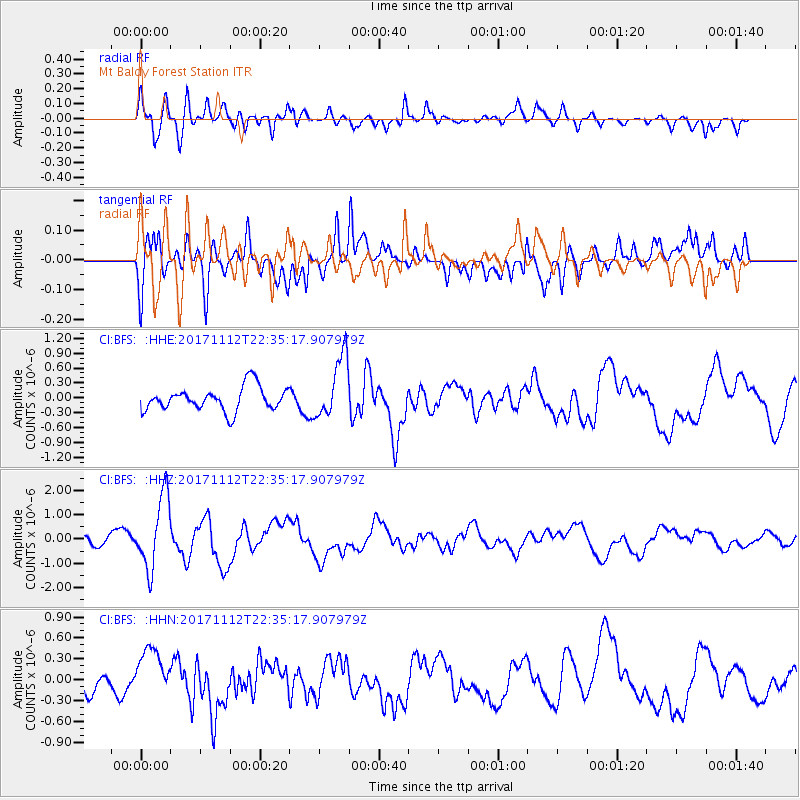
BFS Mt Baldy Forest Station - Earthquake Result Viewer
*The percent match for this event was below the threshold and hence no stack was calculated.
| Earthquake location: |
Off East Coast Of Honshu, Japan |
| Earthquake latitude/longitude: |
38.1/144.9 |
| Earthquake time(UTC): |
2017/11/12 (316) 22:24:07 GMT |
| Earthquake Depth: |
9.5 km |
| Earthquake Magnitude: |
5.8 Mww |
| Earthquake Catalog/Contributor: |
NEIC PDE/us |
|
| Network: |
CI Caltech Regional Seismic Network |
| Station: |
BFS Mt Baldy Forest Station |
| Lat/Lon: |
34.24 N/117.66 W |
| Elevation: |
1312 m |
|
| Distance: |
75.0 deg |
| Az: |
58.263 deg |
| Baz: |
305.865 deg |
| Ray Param: |
$rayparam |
*The percent match for this event was below the threshold and hence was not used in the summary stack. |
|
| Radial Match: |
78.21621 % |
| Radial Bump: |
400 |
| Transverse Match: |
81.768654 % |
| Transverse Bump: |
400 |
| SOD ConfigId: |
13570011 |
| Insert Time: |
2019-04-29 04:40:41.276 +0000 |
| GWidth: |
2.5 |
| Max Bumps: |
400 |
| Tol: |
0.001 |
|
Signal To Noise
| Channel | StoN | STA | LTA |
| CI:BFS: :HHZ:20171112T22:35:17.907979Z | 3.2067401 | 1.4942576E-6 | 4.6597404E-7 |
| CI:BFS: :HHN:20171112T22:35:17.907979Z | 2.707199 | 3.6595887E-7 | 1.3517989E-7 |
| CI:BFS: :HHE:20171112T22:35:17.907979Z | 2.6197338 | 6.2726053E-7 | 2.3943676E-7 |
| Arrivals |
| Ps | |
| PpPs | |
| PsPs/PpSs | |


