You are here: Home > Network List > TA - USArray Transportable Network (new EarthScope stations) Stations List
> Station M18A Lyman, WY, USA > Earthquake Result Viewer
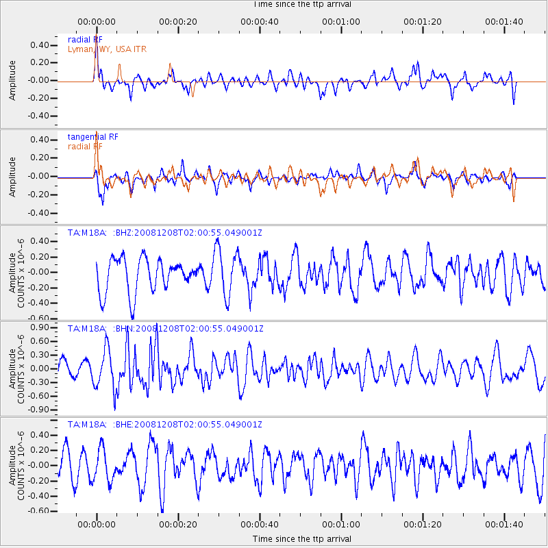
M18A Lyman, WY, USA - Earthquake Result Viewer
*The percent match for this event was below the threshold and hence no stack was calculated.
| Earthquake location: |
Northern Mid-Atlantic Ridge |
| Earthquake latitude/longitude: |
13.4/-44.8 |
| Earthquake time(UTC): |
2008/12/08 (343) 01:51:01 GMT |
| Earthquake Depth: |
10 km |
| Earthquake Magnitude: |
5.6 MB, 5.1 MS, 5.5 MW, 5.5 MW |
| Earthquake Catalog/Contributor: |
WHDF/NEIC |
|
| Network: |
TA USArray Transportable Network (new EarthScope stations) |
| Station: |
M18A Lyman, WY, USA |
| Lat/Lon: |
41.43 N/110.07 W |
| Elevation: |
2103 m |
|
| Distance: |
62.7 deg |
| Az: |
309.79 deg |
| Baz: |
96.131 deg |
| Ray Param: |
$rayparam |
*The percent match for this event was below the threshold and hence was not used in the summary stack. |
|
| Radial Match: |
64.410164 % |
| Radial Bump: |
400 |
| Transverse Match: |
62.8466 % |
| Transverse Bump: |
379 |
| SOD ConfigId: |
2658 |
| Insert Time: |
2010-03-06 06:19:39.969 +0000 |
| GWidth: |
2.5 |
| Max Bumps: |
400 |
| Tol: |
0.001 |
|
Signal To Noise
| Channel | StoN | STA | LTA |
| TA:M18A: :BHN:20081208T02:00:55.049001Z | 2.530244 | 4.3948125E-7 | 1.7369125E-7 |
| TA:M18A: :BHE:20081208T02:00:55.049001Z | 1.2214762 | 2.0998776E-7 | 1.719131E-7 |
| TA:M18A: :BHZ:20081208T02:00:55.049001Z | 1.4531069 | 3.1312916E-7 | 2.1548942E-7 |
| Arrivals |
| Ps | |
| PpPs | |
| PsPs/PpSs | |


