You are here: Home > Network List > TA - USArray Transportable Network (new EarthScope stations) Stations List
> Station M18A Lyman, WY, USA > Earthquake Result Viewer
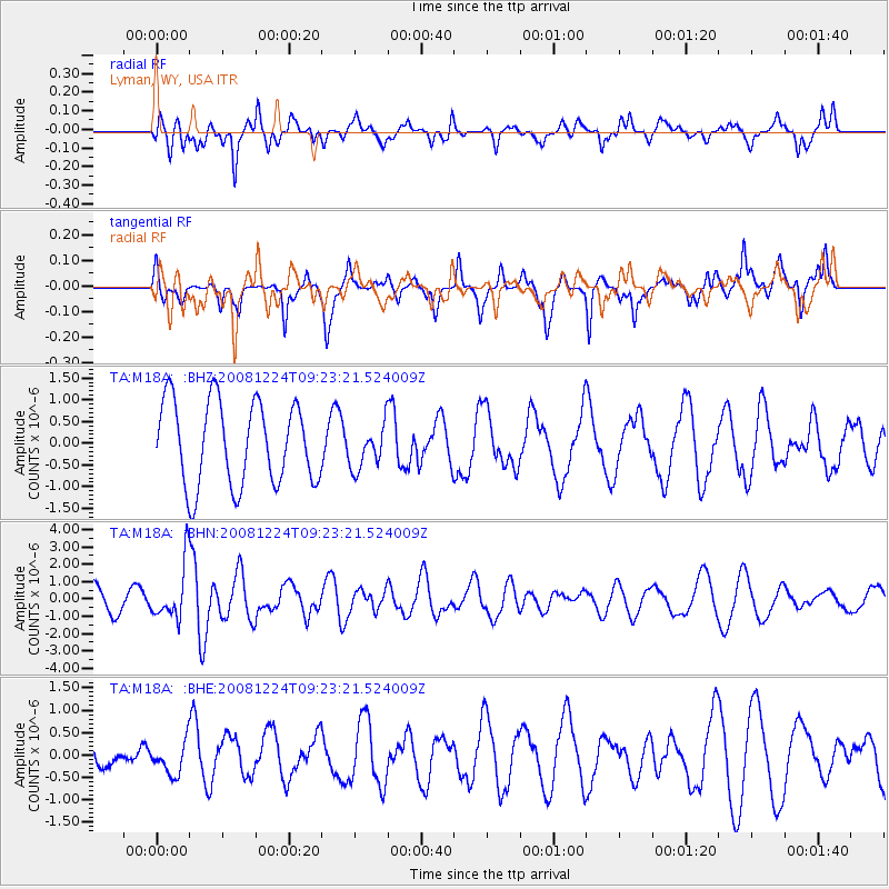
M18A Lyman, WY, USA - Earthquake Result Viewer
*The percent match for this event was below the threshold and hence no stack was calculated.
| Earthquake location: |
Tonga Islands Region |
| Earthquake latitude/longitude: |
-17.3/-171.9 |
| Earthquake time(UTC): |
2008/12/24 (359) 09:11:34 GMT |
| Earthquake Depth: |
9.0 km |
| Earthquake Magnitude: |
5.9 MB, 5.6 MS, 6.0 MW, 6.0 MW |
| Earthquake Catalog/Contributor: |
WHDF/NEIC |
|
| Network: |
TA USArray Transportable Network (new EarthScope stations) |
| Station: |
M18A Lyman, WY, USA |
| Lat/Lon: |
41.43 N/110.07 W |
| Elevation: |
2103 m |
|
| Distance: |
81.7 deg |
| Az: |
42.068 deg |
| Baz: |
238.344 deg |
| Ray Param: |
$rayparam |
*The percent match for this event was below the threshold and hence was not used in the summary stack. |
|
| Radial Match: |
66.186775 % |
| Radial Bump: |
400 |
| Transverse Match: |
56.510967 % |
| Transverse Bump: |
359 |
| SOD ConfigId: |
2658 |
| Insert Time: |
2010-03-06 06:19:49.164 +0000 |
| GWidth: |
2.5 |
| Max Bumps: |
400 |
| Tol: |
0.001 |
|
Signal To Noise
| Channel | StoN | STA | LTA |
| TA:M18A: :BHN:20081224T09:23:21.524009Z | 2.6636229 | 1.5787288E-6 | 5.926998E-7 |
| TA:M18A: :BHE:20081224T09:23:21.524009Z | 0.57074267 | 3.5270966E-7 | 6.1798374E-7 |
| TA:M18A: :BHZ:20081224T09:23:21.524009Z | 0.52410007 | 5.0292874E-7 | 9.596044E-7 |
| Arrivals |
| Ps | |
| PpPs | |
| PsPs/PpSs | |


