You are here: Home > Network List > TA - USArray Transportable Network (new EarthScope stations) Stations List
> Station M18A Lyman, WY, USA > Earthquake Result Viewer
M18A Lyman, WY, USA - Earthquake Result Viewer
*The percent match for this event was below the threshold and hence no stack was calculated.
| Earthquake location: |
Tonga Islands |
| Earthquake latitude/longitude: |
-15.2/-174.2 |
| Earthquake time(UTC): |
2008/11/08 (313) 07:49:59 GMT |
| Earthquake Depth: |
121 km |
| Earthquake Magnitude: |
6.0 MW, 5.4 MB, 6.0 MW |
| Earthquake Catalog/Contributor: |
WHDF/NEIC |
|
| Network: |
TA USArray Transportable Network (new EarthScope stations) |
| Station: |
M18A Lyman, WY, USA |
| Lat/Lon: |
41.43 N/110.07 W |
| Elevation: |
2103 m |
|
| Distance: |
81.7 deg |
| Az: |
43.157 deg |
| Baz: |
241.41 deg |
| Ray Param: |
$rayparam |
*The percent match for this event was below the threshold and hence was not used in the summary stack. |
|
| Radial Match: |
52.71479 % |
| Radial Bump: |
354 |
| Transverse Match: |
44.333553 % |
| Transverse Bump: |
400 |
| SOD ConfigId: |
2658 |
| Insert Time: |
2010-03-06 06:19:52.124 +0000 |
| GWidth: |
2.5 |
| Max Bumps: |
400 |
| Tol: |
0.001 |
|
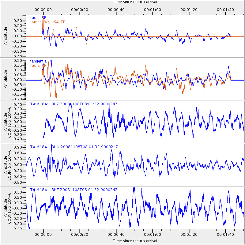
Signal To Noise
| Channel | StoN | STA | LTA |
| TA:M18A: :BHN:20081108T08:01:32.900024Z | 2.1077728 | 4.0542255E-7 | 1.9234642E-7 |
| TA:M18A: :BHE:20081108T08:01:32.900024Z | 0.49544698 | 9.644527E-8 | 1.9466314E-7 |
| TA:M18A: :BHZ:20081108T08:01:32.900024Z | 0.91941345 | 1.7381974E-7 | 1.8905503E-7 |
| Arrivals |
| Ps | |
| PpPs | |
| PsPs/PpSs | |


