You are here: Home > Network List > TA - USArray Transportable Network (new EarthScope stations) Stations List
> Station M20A Sweetwater, Wamsutter, WY, USA > Earthquake Result Viewer
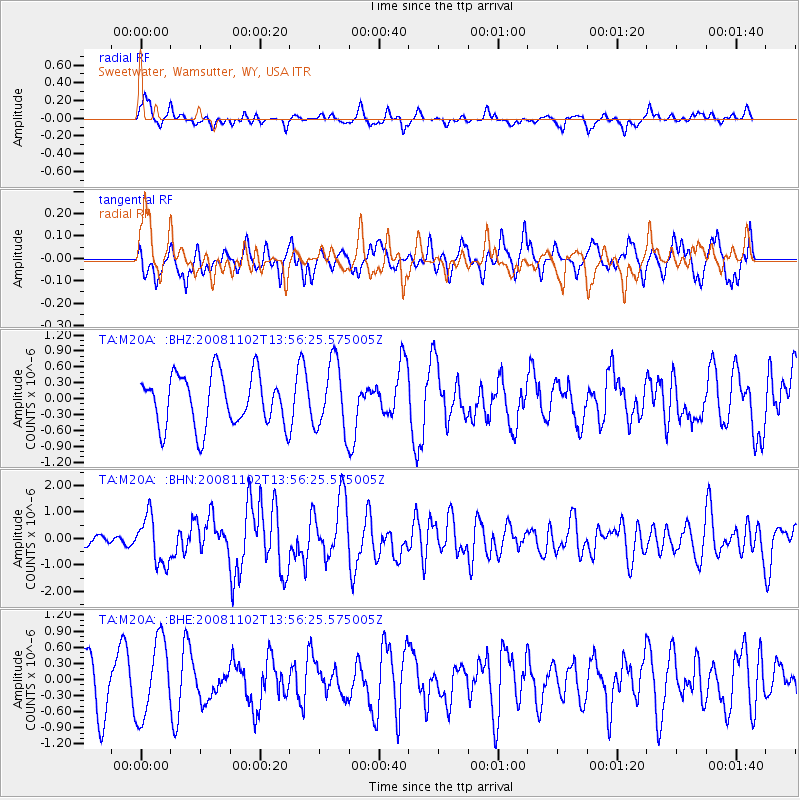
M20A Sweetwater, Wamsutter, WY, USA - Earthquake Result Viewer
*The percent match for this event was below the threshold and hence no stack was calculated.
| Earthquake location: |
Andreanof Islands, Aleutian Is. |
| Earthquake latitude/longitude: |
51.6/-174.4 |
| Earthquake time(UTC): |
2008/11/02 (307) 13:48:42 GMT |
| Earthquake Depth: |
36 km |
| Earthquake Magnitude: |
5.7 MB, 5.8 MS, 6.1 MW, 6.1 MW |
| Earthquake Catalog/Contributor: |
WHDF/NEIC |
|
| Network: |
TA USArray Transportable Network (new EarthScope stations) |
| Station: |
M20A Sweetwater, Wamsutter, WY, USA |
| Lat/Lon: |
41.49 N/108.19 W |
| Elevation: |
2134 m |
|
| Distance: |
45.2 deg |
| Az: |
75.709 deg |
| Baz: |
306.355 deg |
| Ray Param: |
$rayparam |
*The percent match for this event was below the threshold and hence was not used in the summary stack. |
|
| Radial Match: |
62.136536 % |
| Radial Bump: |
358 |
| Transverse Match: |
53.28733 % |
| Transverse Bump: |
400 |
| SOD ConfigId: |
2658 |
| Insert Time: |
2010-03-06 06:21:16.611 +0000 |
| GWidth: |
2.5 |
| Max Bumps: |
400 |
| Tol: |
0.001 |
|
Signal To Noise
| Channel | StoN | STA | LTA |
| TA:M20A: :BHN:20081102T13:56:25.575005Z | 3.5137398 | 8.9251876E-7 | 2.5400823E-7 |
| TA:M20A: :BHE:20081102T13:56:25.575005Z | 1.532882 | 7.1461886E-7 | 4.6619303E-7 |
| TA:M20A: :BHZ:20081102T13:56:25.575005Z | 1.3235724 | 6.488258E-7 | 4.90208E-7 |
| Arrivals |
| Ps | |
| PpPs | |
| PsPs/PpSs | |


