You are here: Home > Network List > TA - USArray Transportable Network (new EarthScope stations) Stations List
> Station G21K Allakaket, AK, USA > Earthquake Result Viewer
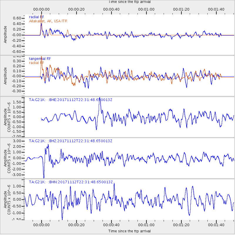
G21K Allakaket, AK, USA - Earthquake Result Viewer
*The percent match for this event was below the threshold and hence no stack was calculated.
| Earthquake location: |
Off East Coast Of Honshu, Japan |
| Earthquake latitude/longitude: |
38.1/144.9 |
| Earthquake time(UTC): |
2017/11/12 (316) 22:24:07 GMT |
| Earthquake Depth: |
9.5 km |
| Earthquake Magnitude: |
5.8 Mww |
| Earthquake Catalog/Contributor: |
NEIC PDE/us |
|
| Network: |
TA USArray Transportable Network (new EarthScope stations) |
| Station: |
G21K Allakaket, AK, USA |
| Lat/Lon: |
66.52 N/153.51 W |
| Elevation: |
446 m |
|
| Distance: |
44.5 deg |
| Az: |
30.178 deg |
| Baz: |
261.972 deg |
| Ray Param: |
$rayparam |
*The percent match for this event was below the threshold and hence was not used in the summary stack. |
|
| Radial Match: |
64.11413 % |
| Radial Bump: |
400 |
| Transverse Match: |
64.74454 % |
| Transverse Bump: |
400 |
| SOD ConfigId: |
13570011 |
| Insert Time: |
2019-04-29 04:48:06.702 +0000 |
| GWidth: |
2.5 |
| Max Bumps: |
400 |
| Tol: |
0.001 |
|
Signal To Noise
| Channel | StoN | STA | LTA |
| TA:G21K: :BHZ:20171112T22:31:48.650013Z | 5.9644837 | 1.5270031E-6 | 2.5601594E-7 |
| TA:G21K: :BHN:20171112T22:31:48.650013Z | 1.0326949 | 2.890429E-7 | 2.7989185E-7 |
| TA:G21K: :BHE:20171112T22:31:48.650013Z | 3.1566446 | 9.067269E-7 | 2.872439E-7 |
| Arrivals |
| Ps | |
| PpPs | |
| PsPs/PpSs | |


