You are here: Home > Network List > TA - USArray Transportable Network (new EarthScope stations) Stations List
> Station M20A Sweetwater, Wamsutter, WY, USA > Earthquake Result Viewer
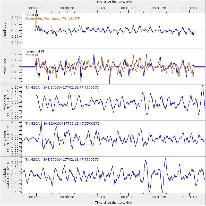
M20A Sweetwater, Wamsutter, WY, USA - Earthquake Result Viewer
*The percent match for this event was below the threshold and hence no stack was calculated.
| Earthquake location: |
Near Coast Of Northern Chile |
| Earthquake latitude/longitude: |
-19.6/-70.5 |
| Earthquake time(UTC): |
2009/04/17 (107) 02:08:08 GMT |
| Earthquake Depth: |
25 km |
| Earthquake Magnitude: |
5.8 MB, 5.8 MS, 6.1 MW, 6.1 MW |
| Earthquake Catalog/Contributor: |
WHDF/NEIC |
|
| Network: |
TA USArray Transportable Network (new EarthScope stations) |
| Station: |
M20A Sweetwater, Wamsutter, WY, USA |
| Lat/Lon: |
41.49 N/108.19 W |
| Elevation: |
2134 m |
|
| Distance: |
70.1 deg |
| Az: |
330.747 deg |
| Baz: |
142.173 deg |
| Ray Param: |
$rayparam |
*The percent match for this event was below the threshold and hence was not used in the summary stack. |
|
| Radial Match: |
57.968185 % |
| Radial Bump: |
326 |
| Transverse Match: |
50.824703 % |
| Transverse Bump: |
346 |
| SOD ConfigId: |
2658 |
| Insert Time: |
2010-03-06 06:21:49.046 +0000 |
| GWidth: |
2.5 |
| Max Bumps: |
400 |
| Tol: |
0.001 |
|
Signal To Noise
| Channel | StoN | STA | LTA |
| TA:M20A: :BHN:20090417T02:18:47.550027Z | 3.066284 | 8.5104637E-7 | 2.7754973E-7 |
| TA:M20A: :BHE:20090417T02:18:47.550027Z | 0.4632729 | 2.3471037E-7 | 5.066352E-7 |
| TA:M20A: :BHZ:20090417T02:18:47.550027Z | 0.52873486 | 1.9741948E-7 | 3.7338089E-7 |
| Arrivals |
| Ps | |
| PpPs | |
| PsPs/PpSs | |


