You are here: Home > Network List > TA - USArray Transportable Network (new EarthScope stations) Stations List
> Station O18K Koktuh Hills, AK, USA > Earthquake Result Viewer
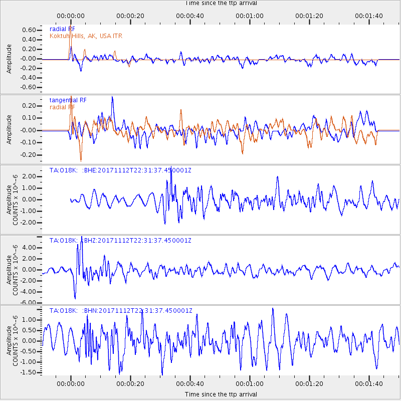
O18K Koktuh Hills, AK, USA - Earthquake Result Viewer
*The percent match for this event was below the threshold and hence no stack was calculated.
| Earthquake location: |
Off East Coast Of Honshu, Japan |
| Earthquake latitude/longitude: |
38.1/144.9 |
| Earthquake time(UTC): |
2017/11/12 (316) 22:24:07 GMT |
| Earthquake Depth: |
9.5 km |
| Earthquake Magnitude: |
5.8 Mww |
| Earthquake Catalog/Contributor: |
NEIC PDE/us |
|
| Network: |
TA USArray Transportable Network (new EarthScope stations) |
| Station: |
O18K Koktuh Hills, AK, USA |
| Lat/Lon: |
59.85 N/155.21 W |
| Elevation: |
544 m |
|
| Distance: |
43.1 deg |
| Az: |
39.693 deg |
| Baz: |
267.324 deg |
| Ray Param: |
$rayparam |
*The percent match for this event was below the threshold and hence was not used in the summary stack. |
|
| Radial Match: |
61.943954 % |
| Radial Bump: |
400 |
| Transverse Match: |
73.793724 % |
| Transverse Bump: |
400 |
| SOD ConfigId: |
13570011 |
| Insert Time: |
2019-04-29 04:49:24.329 +0000 |
| GWidth: |
2.5 |
| Max Bumps: |
400 |
| Tol: |
0.001 |
|
Signal To Noise
| Channel | StoN | STA | LTA |
| TA:O18K: :BHZ:20171112T22:31:37.450001Z | 4.5257244 | 2.8121483E-6 | 6.213698E-7 |
| TA:O18K: :BHN:20171112T22:31:37.450001Z | 1.2109098 | 4.9138794E-7 | 4.0580062E-7 |
| TA:O18K: :BHE:20171112T22:31:37.450001Z | 2.8966537 | 1.091971E-6 | 3.769767E-7 |
| Arrivals |
| Ps | |
| PpPs | |
| PsPs/PpSs | |


