You are here: Home > Network List > UW - Pacific Northwest Regional Seismic Network Stations List
> Station MRBL Marblemount, WA, USA > Earthquake Result Viewer
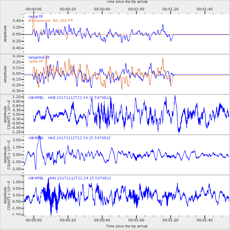
MRBL Marblemount, WA, USA - Earthquake Result Viewer
*The percent match for this event was below the threshold and hence no stack was calculated.
| Earthquake location: |
Off East Coast Of Honshu, Japan |
| Earthquake latitude/longitude: |
38.1/144.9 |
| Earthquake time(UTC): |
2017/11/12 (316) 22:24:07 GMT |
| Earthquake Depth: |
9.5 km |
| Earthquake Magnitude: |
5.8 Mww |
| Earthquake Catalog/Contributor: |
NEIC PDE/us |
|
| Network: |
UW Pacific Northwest Regional Seismic Network |
| Station: |
MRBL Marblemount, WA, USA |
| Lat/Lon: |
48.52 N/121.48 W |
| Elevation: |
75 m |
|
| Distance: |
64.8 deg |
| Az: |
47.153 deg |
| Baz: |
299.483 deg |
| Ray Param: |
$rayparam |
*The percent match for this event was below the threshold and hence was not used in the summary stack. |
|
| Radial Match: |
69.20166 % |
| Radial Bump: |
400 |
| Transverse Match: |
65.88382 % |
| Transverse Bump: |
400 |
| SOD ConfigId: |
13570011 |
| Insert Time: |
2019-04-29 04:50:50.947 +0000 |
| GWidth: |
2.5 |
| Max Bumps: |
400 |
| Tol: |
0.001 |
|
Signal To Noise
| Channel | StoN | STA | LTA |
| UW:MRBL: :HHZ:20171112T22:34:15.597981Z | 3.7398264 | 1.4435841E-6 | 3.8600297E-7 |
| UW:MRBL: :HHN:20171112T22:34:15.597981Z | 1.339361 | 3.5854623E-7 | 2.6769948E-7 |
| UW:MRBL: :HHE:20171112T22:34:15.597981Z | 1.8109151 | 4.7611823E-7 | 2.6291582E-7 |
| Arrivals |
| Ps | |
| PpPs | |
| PsPs/PpSs | |


