You are here: Home > Network List > TA - USArray Transportable Network (new EarthScope stations) Stations List
> Station M20A Sweetwater, Wamsutter, WY, USA > Earthquake Result Viewer
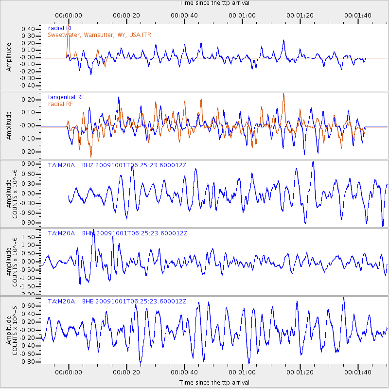
M20A Sweetwater, Wamsutter, WY, USA - Earthquake Result Viewer
*The percent match for this event was below the threshold and hence no stack was calculated.
| Earthquake location: |
Tonga Islands |
| Earthquake latitude/longitude: |
-15.4/-173.3 |
| Earthquake time(UTC): |
2009/10/01 (274) 06:13:32 GMT |
| Earthquake Depth: |
10 km |
| Earthquake Magnitude: |
5.6 MB, 5.7 MS, 5.8 MW, 5.7 MW |
| Earthquake Catalog/Contributor: |
WHDF/NEIC |
|
| Network: |
TA USArray Transportable Network (new EarthScope stations) |
| Station: |
M20A Sweetwater, Wamsutter, WY, USA |
| Lat/Lon: |
41.49 N/108.19 W |
| Elevation: |
2134 m |
|
| Distance: |
82.4 deg |
| Az: |
43.409 deg |
| Baz: |
241.928 deg |
| Ray Param: |
$rayparam |
*The percent match for this event was below the threshold and hence was not used in the summary stack. |
|
| Radial Match: |
48.72919 % |
| Radial Bump: |
298 |
| Transverse Match: |
46.27938 % |
| Transverse Bump: |
366 |
| SOD ConfigId: |
2622 |
| Insert Time: |
2010-03-06 06:22:56.014 +0000 |
| GWidth: |
2.5 |
| Max Bumps: |
400 |
| Tol: |
0.001 |
|
Signal To Noise
| Channel | StoN | STA | LTA |
| TA:M20A: :BHN:20091001T06:25:23.600012Z | 2.241331 | 4.9262076E-7 | 2.1978937E-7 |
| TA:M20A: :BHE:20091001T06:25:23.600012Z | 0.6721398 | 1.06249644E-7 | 1.580767E-7 |
| TA:M20A: :BHZ:20091001T06:25:23.600012Z | 0.81154126 | 2.4769406E-7 | 3.052144E-7 |
| Arrivals |
| Ps | |
| PpPs | |
| PsPs/PpSs | |


