You are here: Home > Network List > TA - USArray Transportable Network (new EarthScope stations) Stations List
> Station M20A Sweetwater, Wamsutter, WY, USA > Earthquake Result Viewer
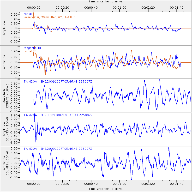
M20A Sweetwater, Wamsutter, WY, USA - Earthquake Result Viewer
*The percent match for this event was below the threshold and hence no stack was calculated.
| Earthquake location: |
Rat Islands, Aleutian Islands |
| Earthquake latitude/longitude: |
52.2/178.1 |
| Earthquake time(UTC): |
2009/10/07 (280) 05:38:37 GMT |
| Earthquake Depth: |
138 km |
| Earthquake Magnitude: |
5.6 MB, 5.6 MW, 5.6 MW |
| Earthquake Catalog/Contributor: |
WHDF/NEIC |
|
| Network: |
TA USArray Transportable Network (new EarthScope stations) |
| Station: |
M20A Sweetwater, Wamsutter, WY, USA |
| Lat/Lon: |
41.49 N/108.19 W |
| Elevation: |
2134 m |
|
| Distance: |
49.5 deg |
| Az: |
71.516 deg |
| Baz: |
308.947 deg |
| Ray Param: |
$rayparam |
*The percent match for this event was below the threshold and hence was not used in the summary stack. |
|
| Radial Match: |
41.169605 % |
| Radial Bump: |
391 |
| Transverse Match: |
26.056074 % |
| Transverse Bump: |
339 |
| SOD ConfigId: |
2622 |
| Insert Time: |
2010-03-06 06:22:58.750 +0000 |
| GWidth: |
2.5 |
| Max Bumps: |
400 |
| Tol: |
0.001 |
|
Signal To Noise
| Channel | StoN | STA | LTA |
| TA:M20A: :BHN:20091007T05:46:43.225007Z | 2.7017214 | 5.424402E-7 | 2.0077579E-7 |
| TA:M20A: :BHE:20091007T05:46:43.225007Z | 2.0763407 | 3.215798E-7 | 1.5487814E-7 |
| TA:M20A: :BHZ:20091007T05:46:43.225007Z | 1.0400076 | 2.4879483E-7 | 2.3922405E-7 |
| Arrivals |
| Ps | |
| PpPs | |
| PsPs/PpSs | |


