You are here: Home > Network List > TA - USArray Transportable Network (new EarthScope stations) Stations List
> Station M20A Sweetwater, Wamsutter, WY, USA > Earthquake Result Viewer
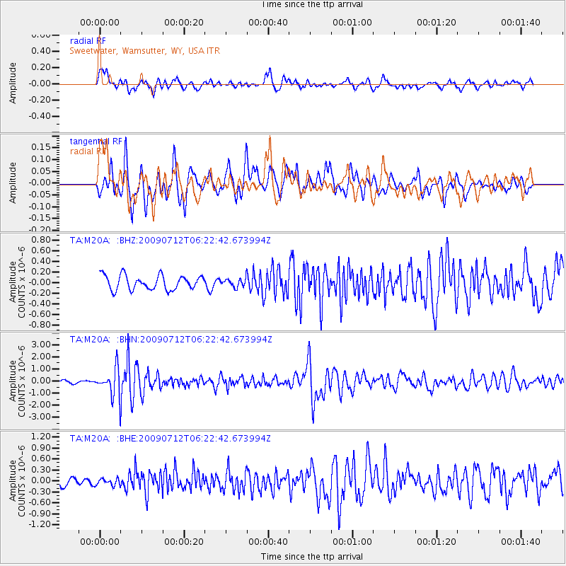
M20A Sweetwater, Wamsutter, WY, USA - Earthquake Result Viewer
*The percent match for this event was below the threshold and hence no stack was calculated.
| Earthquake location: |
Southern Peru |
| Earthquake latitude/longitude: |
-15.0/-70.4 |
| Earthquake time(UTC): |
2009/07/12 (193) 06:12:47 GMT |
| Earthquake Depth: |
199 km |
| Earthquake Magnitude: |
5.7 MB, 6.1 MW, 6.1 MW |
| Earthquake Catalog/Contributor: |
WHDF/NEIC |
|
| Network: |
TA USArray Transportable Network (new EarthScope stations) |
| Station: |
M20A Sweetwater, Wamsutter, WY, USA |
| Lat/Lon: |
41.49 N/108.19 W |
| Elevation: |
2134 m |
|
| Distance: |
66.2 deg |
| Az: |
329.825 deg |
| Baz: |
139.726 deg |
| Ray Param: |
$rayparam |
*The percent match for this event was below the threshold and hence was not used in the summary stack. |
|
| Radial Match: |
74.000626 % |
| Radial Bump: |
400 |
| Transverse Match: |
78.545334 % |
| Transverse Bump: |
400 |
| SOD ConfigId: |
2648 |
| Insert Time: |
2010-03-06 06:23:38.382 +0000 |
| GWidth: |
2.5 |
| Max Bumps: |
400 |
| Tol: |
0.001 |
|
Signal To Noise
| Channel | StoN | STA | LTA |
| TA:M20A: :BHN:20090712T06:22:42.673994Z | 13.518895 | 1.1364588E-6 | 8.406447E-8 |
| TA:M20A: :BHE:20090712T06:22:42.673994Z | 0.69560367 | 8.9154895E-8 | 1.2816909E-7 |
| TA:M20A: :BHZ:20090712T06:22:42.673994Z | 0.59281194 | 8.00981E-8 | 1.3511553E-7 |
| Arrivals |
| Ps | |
| PpPs | |
| PsPs/PpSs | |


