You are here: Home > Network List > TA - USArray Transportable Network (new EarthScope stations) Stations List
> Station C16K Lisburne Hills, AK, USA > Earthquake Result Viewer
C16K Lisburne Hills, AK, USA - Earthquake Result Viewer
*The percent match for this event was below the threshold and hence no stack was calculated.
| Earthquake location: |
Costa Rica |
| Earthquake latitude/longitude: |
9.5/-84.5 |
| Earthquake time(UTC): |
2017/11/13 (317) 02:28:23 GMT |
| Earthquake Depth: |
19 km |
| Earthquake Magnitude: |
6.5 mww |
| Earthquake Catalog/Contributor: |
NEIC PDE/us |
|
| Network: |
TA USArray Transportable Network (new EarthScope stations) |
| Station: |
C16K Lisburne Hills, AK, USA |
| Lat/Lon: |
68.27 N/165.34 W |
| Elevation: |
102 m |
|
| Distance: |
77.8 deg |
| Az: |
337.912 deg |
| Baz: |
94.949 deg |
| Ray Param: |
$rayparam |
*The percent match for this event was below the threshold and hence was not used in the summary stack. |
|
| Radial Match: |
75.48872 % |
| Radial Bump: |
400 |
| Transverse Match: |
66.37688 % |
| Transverse Bump: |
400 |
| SOD ConfigId: |
13570011 |
| Insert Time: |
2019-04-29 05:02:16.955 +0000 |
| GWidth: |
2.5 |
| Max Bumps: |
400 |
| Tol: |
0.001 |
|
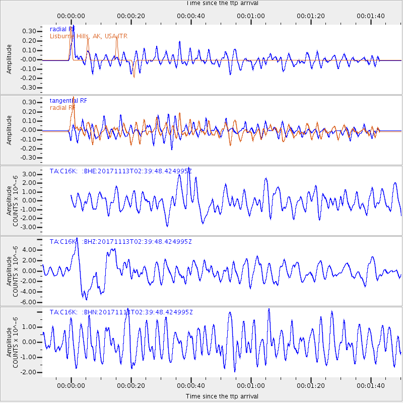
Signal To Noise
| Channel | StoN | STA | LTA |
| TA:C16K: :BHZ:20171113T02:39:48.424995Z | 4.0331984 | 3.6027463E-6 | 8.932727E-7 |
| TA:C16K: :BHN:20171113T02:39:48.424995Z | 2.0115726 | 9.745116E-7 | 4.8445264E-7 |
| TA:C16K: :BHE:20171113T02:39:48.424995Z | 1.6379123 | 1.2239337E-6 | 7.4725233E-7 |
| Arrivals |
| Ps | |
| PpPs | |
| PsPs/PpSs | |


