You are here: Home > Network List > TA - USArray Transportable Network (new EarthScope stations) Stations List
> Station E20K Nigu River, AK, USA > Earthquake Result Viewer
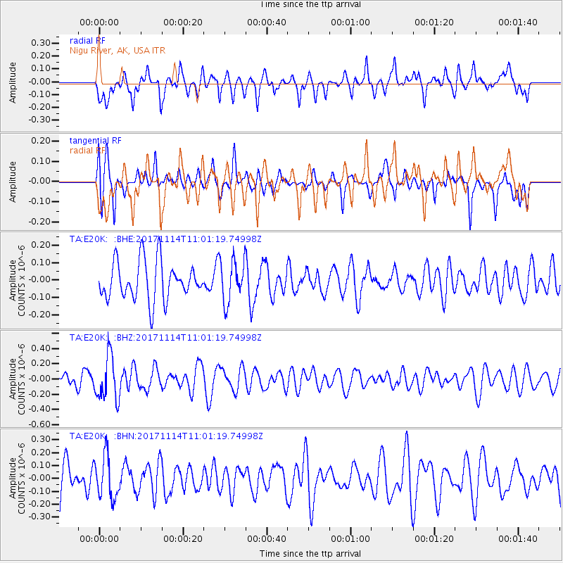
E20K Nigu River, AK, USA - Earthquake Result Viewer
*The percent match for this event was below the threshold and hence no stack was calculated.
| Earthquake location: |
Fiji Islands Region |
| Earthquake latitude/longitude: |
-18.2/-178.0 |
| Earthquake time(UTC): |
2017/11/14 (318) 10:50:05 GMT |
| Earthquake Depth: |
604 km |
| Earthquake Magnitude: |
5.5 Mww |
| Earthquake Catalog/Contributor: |
NEIC PDE/us |
|
| Network: |
TA USArray Transportable Network (new EarthScope stations) |
| Station: |
E20K Nigu River, AK, USA |
| Lat/Lon: |
68.26 N/156.19 W |
| Elevation: |
866 m |
|
| Distance: |
87.6 deg |
| Az: |
7.96 deg |
| Baz: |
200.694 deg |
| Ray Param: |
$rayparam |
*The percent match for this event was below the threshold and hence was not used in the summary stack. |
|
| Radial Match: |
53.17421 % |
| Radial Bump: |
400 |
| Transverse Match: |
53.68005 % |
| Transverse Bump: |
400 |
| SOD ConfigId: |
13570011 |
| Insert Time: |
2019-04-29 05:11:15.121 +0000 |
| GWidth: |
2.5 |
| Max Bumps: |
400 |
| Tol: |
0.001 |
|
Signal To Noise
| Channel | StoN | STA | LTA |
| TA:E20K: :BHZ:20171114T11:01:19.74998Z | 2.2869093 | 2.9773025E-7 | 1.3018892E-7 |
| TA:E20K: :BHN:20171114T11:01:19.74998Z | 1.3581249 | 1.6544887E-7 | 1.2182154E-7 |
| TA:E20K: :BHE:20171114T11:01:19.74998Z | 1.0789179 | 1.1934688E-7 | 1.1061721E-7 |
| Arrivals |
| Ps | |
| PpPs | |
| PsPs/PpSs | |


