You are here: Home > Network List > TA - USArray Transportable Network (new EarthScope stations) Stations List
> Station I23K Minto, Yukon-Koyukuk, AK, USA > Earthquake Result Viewer
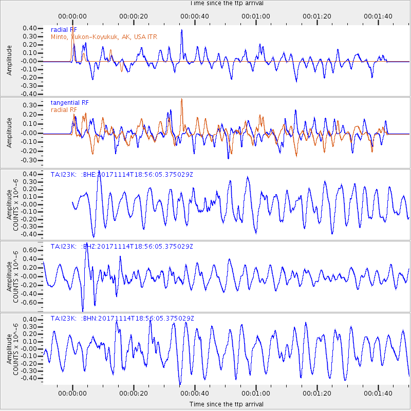
I23K Minto, Yukon-Koyukuk, AK, USA - Earthquake Result Viewer
*The percent match for this event was below the threshold and hence no stack was calculated.
| Earthquake location: |
Tonga Islands Region |
| Earthquake latitude/longitude: |
-18.6/-171.5 |
| Earthquake time(UTC): |
2017/11/14 (318) 18:44:00 GMT |
| Earthquake Depth: |
10 km |
| Earthquake Magnitude: |
5.4 Mww |
| Earthquake Catalog/Contributor: |
NEIC PDE/us |
|
| Network: |
TA USArray Transportable Network (new EarthScope stations) |
| Station: |
I23K Minto, Yukon-Koyukuk, AK, USA |
| Lat/Lon: |
65.15 N/149.36 W |
| Elevation: |
149 m |
|
| Distance: |
85.2 deg |
| Az: |
9.202 deg |
| Baz: |
201.03 deg |
| Ray Param: |
$rayparam |
*The percent match for this event was below the threshold and hence was not used in the summary stack. |
|
| Radial Match: |
63.662083 % |
| Radial Bump: |
400 |
| Transverse Match: |
55.951435 % |
| Transverse Bump: |
343 |
| SOD ConfigId: |
13570011 |
| Insert Time: |
2019-04-29 05:18:54.092 +0000 |
| GWidth: |
2.5 |
| Max Bumps: |
400 |
| Tol: |
0.001 |
|
Signal To Noise
| Channel | StoN | STA | LTA |
| TA:I23K: :BHZ:20171114T18:56:05.375029Z | 2.420594 | 3.7272292E-7 | 1.5397994E-7 |
| TA:I23K: :BHN:20171114T18:56:05.375029Z | 1.0631998 | 1.3235326E-7 | 1.244858E-7 |
| TA:I23K: :BHE:20171114T18:56:05.375029Z | 0.850532 | 1.5066394E-7 | 1.7714082E-7 |
| Arrivals |
| Ps | |
| PpPs | |
| PsPs/PpSs | |


