You are here: Home > Network List > AK - Alaska Regional Network Stations List
> Station MDM Murphy Dome > Earthquake Result Viewer
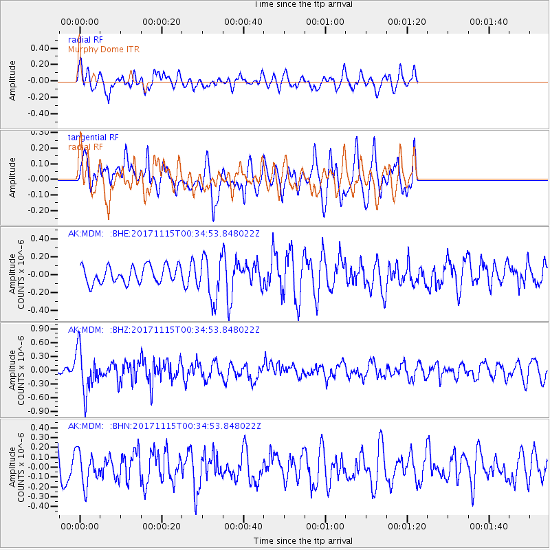
MDM Murphy Dome - Earthquake Result Viewer
*The percent match for this event was below the threshold and hence no stack was calculated.
| Earthquake location: |
South Of Mariana Islands |
| Earthquake latitude/longitude: |
13.1/143.7 |
| Earthquake time(UTC): |
2017/11/15 (319) 00:24:32 GMT |
| Earthquake Depth: |
123 km |
| Earthquake Magnitude: |
5.8 Mww |
| Earthquake Catalog/Contributor: |
NEIC PDE/us |
|
| Network: |
AK Alaska Regional Network |
| Station: |
MDM Murphy Dome |
| Lat/Lon: |
64.96 N/148.23 W |
| Elevation: |
634 m |
|
| Distance: |
69.0 deg |
| Az: |
25.021 deg |
| Baz: |
255.543 deg |
| Ray Param: |
$rayparam |
*The percent match for this event was below the threshold and hence was not used in the summary stack. |
|
| Radial Match: |
59.0266 % |
| Radial Bump: |
400 |
| Transverse Match: |
57.66451 % |
| Transverse Bump: |
400 |
| SOD ConfigId: |
13570011 |
| Insert Time: |
2019-04-29 05:21:35.882 +0000 |
| GWidth: |
2.5 |
| Max Bumps: |
400 |
| Tol: |
0.001 |
|
Signal To Noise
| Channel | StoN | STA | LTA |
| AK:MDM: :BHZ:20171115T00:34:53.848022Z | 4.6480303 | 4.6789967E-7 | 1.0066623E-7 |
| AK:MDM: :BHN:20171115T00:34:53.848022Z | 1.0692372 | 1.6277198E-7 | 1.5223186E-7 |
| AK:MDM: :BHE:20171115T00:34:53.848022Z | 2.67937 | 2.5003266E-7 | 9.331771E-8 |
| Arrivals |
| Ps | |
| PpPs | |
| PsPs/PpSs | |


