You are here: Home > Network List > AV - Alaska Volcano Observatory Stations List
> Station MNAT Nateekin Bay, Makushin Volcano, Alaska > Earthquake Result Viewer
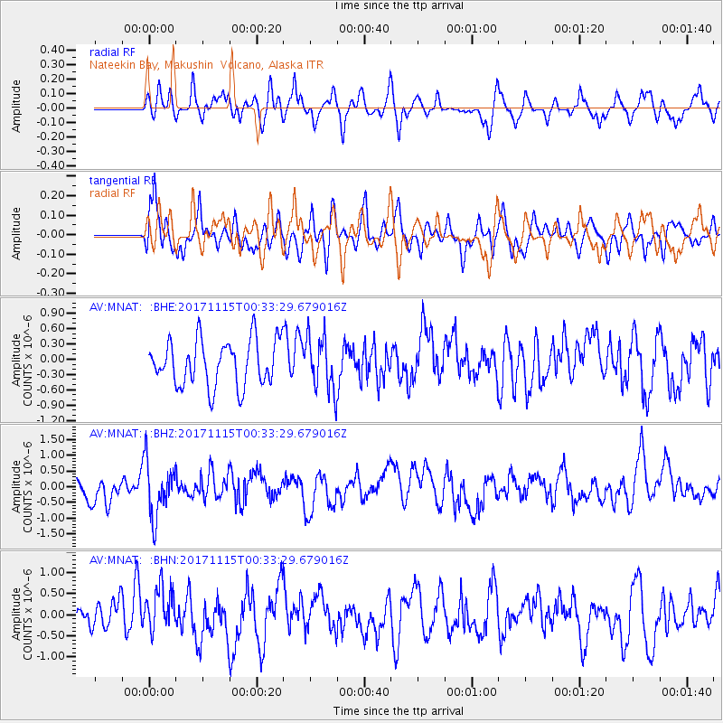
MNAT Nateekin Bay, Makushin Volcano, Alaska - Earthquake Result Viewer
*The percent match for this event was below the threshold and hence no stack was calculated.
| Earthquake location: |
South Of Mariana Islands |
| Earthquake latitude/longitude: |
13.1/143.7 |
| Earthquake time(UTC): |
2017/11/15 (319) 00:24:32 GMT |
| Earthquake Depth: |
123 km |
| Earthquake Magnitude: |
5.8 Mww |
| Earthquake Catalog/Contributor: |
NEIC PDE/us |
|
| Network: |
AV Alaska Volcano Observatory |
| Station: |
MNAT Nateekin Bay, Makushin Volcano, Alaska |
| Lat/Lon: |
53.88 N/166.69 W |
| Elevation: |
390 m |
|
| Distance: |
56.3 deg |
| Az: |
32.835 deg |
| Baz: |
243.184 deg |
| Ray Param: |
$rayparam |
*The percent match for this event was below the threshold and hence was not used in the summary stack. |
|
| Radial Match: |
51.94313 % |
| Radial Bump: |
400 |
| Transverse Match: |
47.05529 % |
| Transverse Bump: |
400 |
| SOD ConfigId: |
13570011 |
| Insert Time: |
2019-04-29 05:22:26.651 +0000 |
| GWidth: |
2.5 |
| Max Bumps: |
400 |
| Tol: |
0.001 |
|
Signal To Noise
| Channel | StoN | STA | LTA |
| AV:MNAT: :BHZ:20171115T00:33:29.679016Z | 2.2747934 | 8.795882E-7 | 3.8666727E-7 |
| AV:MNAT: :BHN:20171115T00:33:29.679016Z | 1.320363 | 5.293184E-7 | 4.0088852E-7 |
| AV:MNAT: :BHE:20171115T00:33:29.679016Z | 1.2034249 | 5.463271E-7 | 4.539769E-7 |
| Arrivals |
| Ps | |
| PpPs | |
| PsPs/PpSs | |


