You are here: Home > Network List > CI - Caltech Regional Seismic Network Stations List
> Station BAR Barrett, Tecate, CA, USA > Earthquake Result Viewer
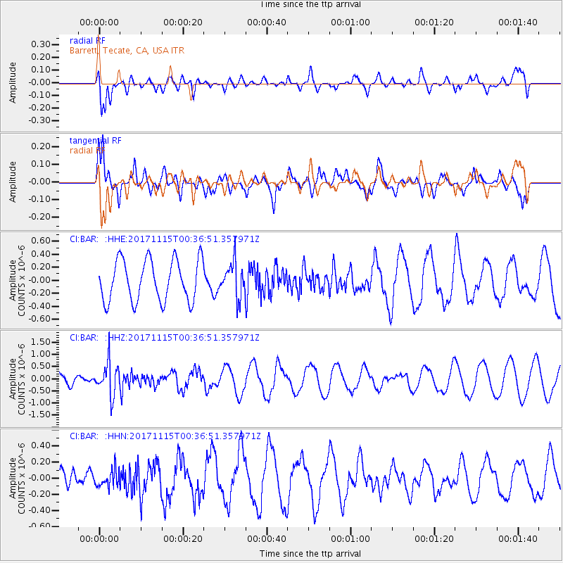
BAR Barrett, Tecate, CA, USA - Earthquake Result Viewer
*The percent match for this event was below the threshold and hence no stack was calculated.
| Earthquake location: |
South Of Mariana Islands |
| Earthquake latitude/longitude: |
13.1/143.7 |
| Earthquake time(UTC): |
2017/11/15 (319) 00:24:32 GMT |
| Earthquake Depth: |
123 km |
| Earthquake Magnitude: |
5.8 Mww |
| Earthquake Catalog/Contributor: |
NEIC PDE/us |
|
| Network: |
CI Caltech Regional Seismic Network |
| Station: |
BAR Barrett, Tecate, CA, USA |
| Lat/Lon: |
32.68 N/116.67 W |
| Elevation: |
521 m |
|
| Distance: |
91.0 deg |
| Az: |
56.252 deg |
| Baz: |
286.108 deg |
| Ray Param: |
$rayparam |
*The percent match for this event was below the threshold and hence was not used in the summary stack. |
|
| Radial Match: |
71.34974 % |
| Radial Bump: |
400 |
| Transverse Match: |
77.2241 % |
| Transverse Bump: |
400 |
| SOD ConfigId: |
13570011 |
| Insert Time: |
2019-04-29 05:23:05.305 +0000 |
| GWidth: |
2.5 |
| Max Bumps: |
400 |
| Tol: |
0.001 |
|
Signal To Noise
| Channel | StoN | STA | LTA |
| CI:BAR: :HHZ:20171115T00:36:51.357971Z | 2.5092187 | 6.89706E-7 | 2.7486882E-7 |
| CI:BAR: :HHN:20171115T00:36:51.357971Z | 0.73023254 | 1.0362988E-7 | 1.4191353E-7 |
| CI:BAR: :HHE:20171115T00:36:51.357971Z | 0.85409 | 2.718931E-7 | 3.1834244E-7 |
| Arrivals |
| Ps | |
| PpPs | |
| PsPs/PpSs | |


