You are here: Home > Network List > CI - Caltech Regional Seismic Network Stations List
> Station DAN Danby, California, USA > Earthquake Result Viewer
DAN Danby, California, USA - Earthquake Result Viewer
*The percent match for this event was below the threshold and hence no stack was calculated.
| Earthquake location: |
South Of Mariana Islands |
| Earthquake latitude/longitude: |
13.1/143.7 |
| Earthquake time(UTC): |
2017/11/15 (319) 00:24:32 GMT |
| Earthquake Depth: |
123 km |
| Earthquake Magnitude: |
5.8 Mww |
| Earthquake Catalog/Contributor: |
NEIC PDE/us |
|
| Network: |
CI Caltech Regional Seismic Network |
| Station: |
DAN Danby, California, USA |
| Lat/Lon: |
34.64 N/115.38 W |
| Elevation: |
398 m |
|
| Distance: |
91.5 deg |
| Az: |
54.074 deg |
| Baz: |
286.868 deg |
| Ray Param: |
$rayparam |
*The percent match for this event was below the threshold and hence was not used in the summary stack. |
|
| Radial Match: |
79.99914 % |
| Radial Bump: |
400 |
| Transverse Match: |
70.51168 % |
| Transverse Bump: |
400 |
| SOD ConfigId: |
13570011 |
| Insert Time: |
2019-04-29 05:23:11.401 +0000 |
| GWidth: |
2.5 |
| Max Bumps: |
400 |
| Tol: |
0.001 |
|
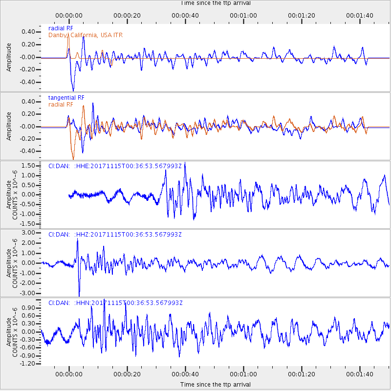
Signal To Noise
| Channel | StoN | STA | LTA |
| CI:DAN: :HHZ:20171115T00:36:53.567993Z | 5.947471 | 1.0465948E-6 | 1.7597306E-7 |
| CI:DAN: :HHN:20171115T00:36:53.567993Z | 1.103165 | 2.6076376E-7 | 2.3637783E-7 |
| CI:DAN: :HHE:20171115T00:36:53.567993Z | 3.3707032 | 5.397655E-7 | 1.6013439E-7 |
| Arrivals |
| Ps | |
| PpPs | |
| PsPs/PpSs | |


