You are here: Home > Network List > CN - Canadian National Seismograph Network Stations List
> Station INK INUVIK, NT > Earthquake Result Viewer
INK INUVIK, NT - Earthquake Result Viewer
*The percent match for this event was below the threshold and hence no stack was calculated.
| Earthquake location: |
South Of Mariana Islands |
| Earthquake latitude/longitude: |
13.1/143.7 |
| Earthquake time(UTC): |
2017/11/15 (319) 00:24:32 GMT |
| Earthquake Depth: |
123 km |
| Earthquake Magnitude: |
5.8 Mww |
| Earthquake Catalog/Contributor: |
NEIC PDE/us |
|
| Network: |
CN Canadian National Seismograph Network |
| Station: |
INK INUVIK, NT |
| Lat/Lon: |
68.31 N/133.53 W |
| Elevation: |
44 m |
|
| Distance: |
75.3 deg |
| Az: |
22.418 deg |
| Baz: |
268.245 deg |
| Ray Param: |
$rayparam |
*The percent match for this event was below the threshold and hence was not used in the summary stack. |
|
| Radial Match: |
49.923794 % |
| Radial Bump: |
400 |
| Transverse Match: |
63.28943 % |
| Transverse Bump: |
400 |
| SOD ConfigId: |
13570011 |
| Insert Time: |
2019-04-29 05:23:53.386 +0000 |
| GWidth: |
2.5 |
| Max Bumps: |
400 |
| Tol: |
0.001 |
|
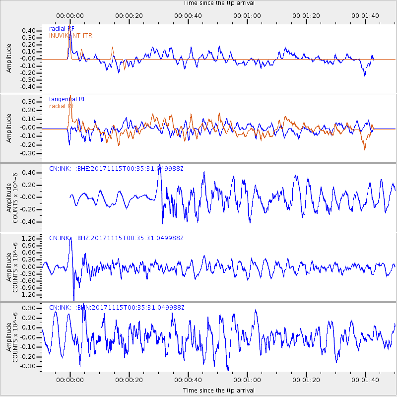
Signal To Noise
| Channel | StoN | STA | LTA |
| CN:INK: :BHZ:20171115T00:35:31.049988Z | 5.7133355 | 6.623043E-7 | 1.1592252E-7 |
| CN:INK: :BHN:20171115T00:35:31.049988Z | 1.8798252 | 1.8459153E-7 | 9.819611E-8 |
| CN:INK: :BHE:20171115T00:35:31.049988Z | 3.5796268 | 2.5863145E-7 | 7.225095E-8 |
| Arrivals |
| Ps | |
| PpPs | |
| PsPs/PpSs | |


