You are here: Home > Network List > TA - USArray Transportable Network (new EarthScope stations) Stations List
> Station K20A Yellowstone Ranch, Lander, WY, USA > Earthquake Result Viewer
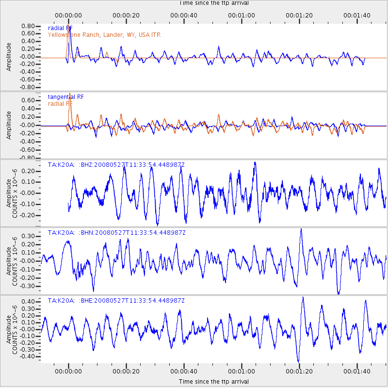
K20A Yellowstone Ranch, Lander, WY, USA - Earthquake Result Viewer
*The percent match for this event was below the threshold and hence no stack was calculated.
| Earthquake location: |
Near Coast Of Guatemala |
| Earthquake latitude/longitude: |
13.6/-91.0 |
| Earthquake time(UTC): |
2008/05/27 (148) 11:27:55 GMT |
| Earthquake Depth: |
26 km |
| Earthquake Magnitude: |
5.7 MW, 5.1 MS, 5.3 MB, 5.6 MW |
| Earthquake Catalog/Contributor: |
WHDF/NEIC |
|
| Network: |
TA USArray Transportable Network (new EarthScope stations) |
| Station: |
K20A Yellowstone Ranch, Lander, WY, USA |
| Lat/Lon: |
42.66 N/108.34 W |
| Elevation: |
1736 m |
|
| Distance: |
32.6 deg |
| Az: |
335.93 deg |
| Baz: |
147.483 deg |
| Ray Param: |
$rayparam |
*The percent match for this event was below the threshold and hence was not used in the summary stack. |
|
| Radial Match: |
57.100296 % |
| Radial Bump: |
353 |
| Transverse Match: |
44.87187 % |
| Transverse Bump: |
293 |
| SOD ConfigId: |
2504 |
| Insert Time: |
2010-03-06 06:30:55.158 +0000 |
| GWidth: |
2.5 |
| Max Bumps: |
400 |
| Tol: |
0.001 |
|
Signal To Noise
| Channel | StoN | STA | LTA |
| TA:K20A: :BHN:20080527T11:33:54.448987Z | 2.9094288 | 1.6186351E-7 | 5.5634118E-8 |
| TA:K20A: :BHE:20080527T11:33:54.448987Z | 1.1864275 | 1.1524215E-7 | 9.713375E-8 |
| TA:K20A: :BHZ:20080527T11:33:54.448987Z | 1.4028924 | 1.3763504E-7 | 9.810806E-8 |
| Arrivals |
| Ps | |
| PpPs | |
| PsPs/PpSs | |


