You are here: Home > Network List > TA - USArray Transportable Network (new EarthScope stations) Stations List
> Station E20K Nigu River, AK, USA > Earthquake Result Viewer
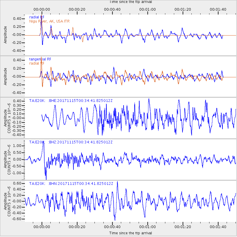
E20K Nigu River, AK, USA - Earthquake Result Viewer
*The percent match for this event was below the threshold and hence no stack was calculated.
| Earthquake location: |
South Of Mariana Islands |
| Earthquake latitude/longitude: |
13.1/143.7 |
| Earthquake time(UTC): |
2017/11/15 (319) 00:24:32 GMT |
| Earthquake Depth: |
123 km |
| Earthquake Magnitude: |
5.8 Mww |
| Earthquake Catalog/Contributor: |
NEIC PDE/us |
|
| Network: |
TA USArray Transportable Network (new EarthScope stations) |
| Station: |
E20K Nigu River, AK, USA |
| Lat/Lon: |
68.26 N/156.19 W |
| Elevation: |
866 m |
|
| Distance: |
67.1 deg |
| Az: |
20.538 deg |
| Baz: |
246.564 deg |
| Ray Param: |
$rayparam |
*The percent match for this event was below the threshold and hence was not used in the summary stack. |
|
| Radial Match: |
63.67009 % |
| Radial Bump: |
400 |
| Transverse Match: |
60.21949 % |
| Transverse Bump: |
400 |
| SOD ConfigId: |
13570011 |
| Insert Time: |
2019-04-29 05:26:52.310 +0000 |
| GWidth: |
2.5 |
| Max Bumps: |
400 |
| Tol: |
0.001 |
|
Signal To Noise
| Channel | StoN | STA | LTA |
| TA:E20K: :BHZ:20171115T00:34:41.825012Z | 4.5538507 | 7.168287E-7 | 1.5741155E-7 |
| TA:E20K: :BHN:20171115T00:34:41.825012Z | 0.9879107 | 1.3666494E-7 | 1.3833734E-7 |
| TA:E20K: :BHE:20171115T00:34:41.825012Z | 1.6694556 | 2.2798447E-7 | 1.3656216E-7 |
| Arrivals |
| Ps | |
| PpPs | |
| PsPs/PpSs | |


