You are here: Home > Network List > TA - USArray Transportable Network (new EarthScope stations) Stations List
> Station E18K Tukpahlearik Creek, AK, USA > Earthquake Result Viewer
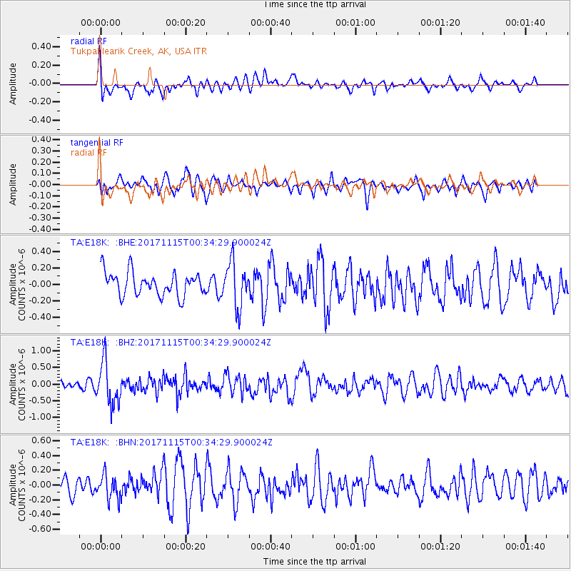
E18K Tukpahlearik Creek, AK, USA - Earthquake Result Viewer
*The percent match for this event was below the threshold and hence no stack was calculated.
| Earthquake location: |
South Of Mariana Islands |
| Earthquake latitude/longitude: |
13.1/143.7 |
| Earthquake time(UTC): |
2017/11/15 (319) 00:24:32 GMT |
| Earthquake Depth: |
123 km |
| Earthquake Magnitude: |
5.8 Mww |
| Earthquake Catalog/Contributor: |
NEIC PDE/us |
|
| Network: |
TA USArray Transportable Network (new EarthScope stations) |
| Station: |
E18K Tukpahlearik Creek, AK, USA |
| Lat/Lon: |
67.42 N/160.60 W |
| Elevation: |
297 m |
|
| Distance: |
65.2 deg |
| Az: |
20.579 deg |
| Baz: |
242.496 deg |
| Ray Param: |
$rayparam |
*The percent match for this event was below the threshold and hence was not used in the summary stack. |
|
| Radial Match: |
53.541927 % |
| Radial Bump: |
400 |
| Transverse Match: |
59.089775 % |
| Transverse Bump: |
400 |
| SOD ConfigId: |
13570011 |
| Insert Time: |
2019-04-29 05:26:52.347 +0000 |
| GWidth: |
2.5 |
| Max Bumps: |
400 |
| Tol: |
0.001 |
|
Signal To Noise
| Channel | StoN | STA | LTA |
| TA:E18K: :BHZ:20171115T00:34:29.900024Z | 3.6060638 | 6.466228E-7 | 1.793154E-7 |
| TA:E18K: :BHN:20171115T00:34:29.900024Z | 1.0452516 | 1.7062929E-7 | 1.6324232E-7 |
| TA:E18K: :BHE:20171115T00:34:29.900024Z | 1.9861542 | 2.773271E-7 | 1.3963019E-7 |
| Arrivals |
| Ps | |
| PpPs | |
| PsPs/PpSs | |


