You are here: Home > Network List > TA - USArray Transportable Network (new EarthScope stations) Stations List
> Station H16K Elim, AK, USA > Earthquake Result Viewer
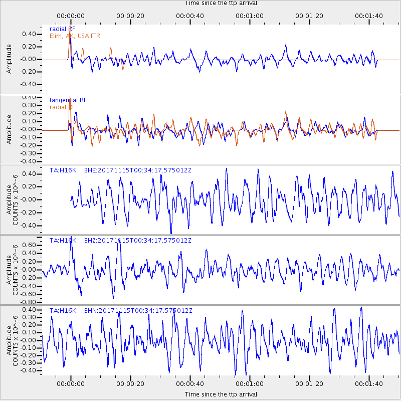
H16K Elim, AK, USA - Earthquake Result Viewer
*The percent match for this event was below the threshold and hence no stack was calculated.
| Earthquake location: |
South Of Mariana Islands |
| Earthquake latitude/longitude: |
13.1/143.7 |
| Earthquake time(UTC): |
2017/11/15 (319) 00:24:32 GMT |
| Earthquake Depth: |
123 km |
| Earthquake Magnitude: |
5.8 Mww |
| Earthquake Catalog/Contributor: |
NEIC PDE/us |
|
| Network: |
TA USArray Transportable Network (new EarthScope stations) |
| Station: |
H16K Elim, AK, USA |
| Lat/Lon: |
64.64 N/162.24 W |
| Elevation: |
216 m |
|
| Distance: |
63.3 deg |
| Az: |
22.981 deg |
| Baz: |
242.045 deg |
| Ray Param: |
$rayparam |
*The percent match for this event was below the threshold and hence was not used in the summary stack. |
|
| Radial Match: |
57.90534 % |
| Radial Bump: |
400 |
| Transverse Match: |
52.07374 % |
| Transverse Bump: |
397 |
| SOD ConfigId: |
13570011 |
| Insert Time: |
2019-04-29 05:27:31.588 +0000 |
| GWidth: |
2.5 |
| Max Bumps: |
400 |
| Tol: |
0.001 |
|
Signal To Noise
| Channel | StoN | STA | LTA |
| TA:H16K: :BHZ:20171115T00:34:17.575012Z | 2.5861075 | 3.7096794E-7 | 1.4344644E-7 |
| TA:H16K: :BHN:20171115T00:34:17.575012Z | 0.9759362 | 1.3853516E-7 | 1.4195105E-7 |
| TA:H16K: :BHE:20171115T00:34:17.575012Z | 1.4431428 | 2.4386688E-7 | 1.689832E-7 |
| Arrivals |
| Ps | |
| PpPs | |
| PsPs/PpSs | |


