You are here: Home > Network List > TA - USArray Transportable Network (new EarthScope stations) Stations List
> Station L15K Ungalak Mountain, AK, USA > Earthquake Result Viewer
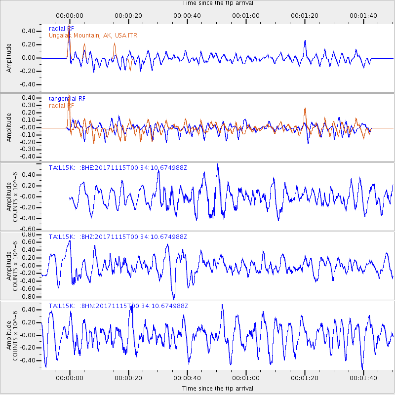
L15K Ungalak Mountain, AK, USA - Earthquake Result Viewer
*The percent match for this event was below the threshold and hence no stack was calculated.
| Earthquake location: |
South Of Mariana Islands |
| Earthquake latitude/longitude: |
13.1/143.7 |
| Earthquake time(UTC): |
2017/11/15 (319) 00:24:32 GMT |
| Earthquake Depth: |
123 km |
| Earthquake Magnitude: |
5.8 Mww |
| Earthquake Catalog/Contributor: |
NEIC PDE/us |
|
| Network: |
TA USArray Transportable Network (new EarthScope stations) |
| Station: |
L15K Ungalak Mountain, AK, USA |
| Lat/Lon: |
61.68 N/161.49 W |
| Elevation: |
219 m |
|
| Distance: |
62.3 deg |
| Az: |
26.134 deg |
| Baz: |
244.157 deg |
| Ray Param: |
$rayparam |
*The percent match for this event was below the threshold and hence was not used in the summary stack. |
|
| Radial Match: |
51.800064 % |
| Radial Bump: |
400 |
| Transverse Match: |
51.292786 % |
| Transverse Bump: |
400 |
| SOD ConfigId: |
13570011 |
| Insert Time: |
2019-04-29 05:27:58.491 +0000 |
| GWidth: |
2.5 |
| Max Bumps: |
400 |
| Tol: |
0.001 |
|
Signal To Noise
| Channel | StoN | STA | LTA |
| TA:L15K: :BHZ:20171115T00:34:10.674988Z | 2.316094 | 3.6702676E-7 | 1.5846798E-7 |
| TA:L15K: :BHN:20171115T00:34:10.674988Z | 0.89820474 | 1.9647506E-7 | 2.1874195E-7 |
| TA:L15K: :BHE:20171115T00:34:10.674988Z | 1.3159949 | 2.1000943E-7 | 1.5958226E-7 |
| Arrivals |
| Ps | |
| PpPs | |
| PsPs/PpSs | |


