You are here: Home > Network List > TA - USArray Transportable Network (new EarthScope stations) Stations List
> Station K20A Yellowstone Ranch, Lander, WY, USA > Earthquake Result Viewer
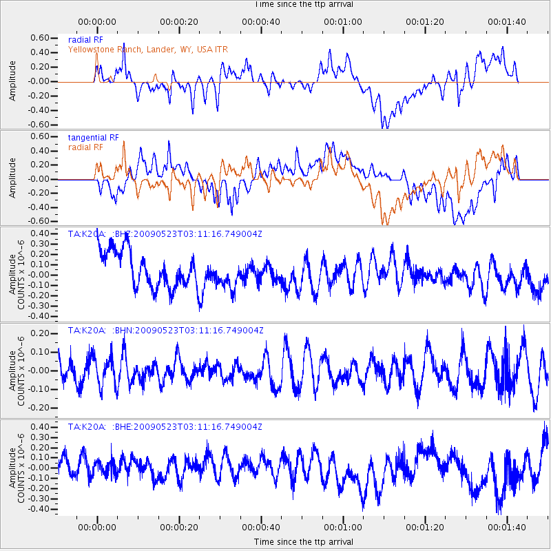
K20A Yellowstone Ranch, Lander, WY, USA - Earthquake Result Viewer
*The percent match for this event was below the threshold and hence no stack was calculated.
| Earthquake location: |
South Of Fiji Islands |
| Earthquake latitude/longitude: |
-24.4/178.8 |
| Earthquake time(UTC): |
2009/05/23 (143) 02:59:28 GMT |
| Earthquake Depth: |
566 km |
| Earthquake Magnitude: |
5.5 MW, 5.1 MB |
| Earthquake Catalog/Contributor: |
WHDF/NEIC |
|
| Network: |
TA USArray Transportable Network (new EarthScope stations) |
| Station: |
K20A Yellowstone Ranch, Lander, WY, USA |
| Lat/Lon: |
42.66 N/108.34 W |
| Elevation: |
1736 m |
|
| Distance: |
94.5 deg |
| Az: |
44.984 deg |
| Baz: |
240.906 deg |
| Ray Param: |
$rayparam |
*The percent match for this event was below the threshold and hence was not used in the summary stack. |
|
| Radial Match: |
53.63606 % |
| Radial Bump: |
400 |
| Transverse Match: |
50.483032 % |
| Transverse Bump: |
400 |
| SOD ConfigId: |
2648 |
| Insert Time: |
2010-03-06 06:31:46.752 +0000 |
| GWidth: |
2.5 |
| Max Bumps: |
400 |
| Tol: |
0.001 |
|
Signal To Noise
| Channel | StoN | STA | LTA |
| TA:K20A: :BHN:20090523T03:11:16.749004Z | 0.79632175 | 7.743593E-8 | 9.7242015E-8 |
| TA:K20A: :BHE:20090523T03:11:16.749004Z | 0.9595414 | 1.2580993E-7 | 1.3111466E-7 |
| TA:K20A: :BHZ:20090523T03:11:16.749004Z | 0.84716415 | 1.481968E-7 | 1.7493282E-7 |
| Arrivals |
| Ps | |
| PpPs | |
| PsPs/PpSs | |


