You are here: Home > Network List > TA - USArray Transportable Network (new EarthScope stations) Stations List
> Station I23K Minto, Yukon-Koyukuk, AK, USA > Earthquake Result Viewer
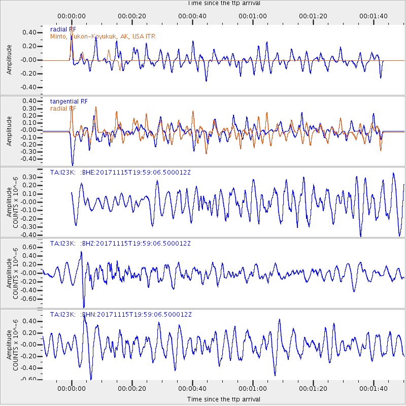
I23K Minto, Yukon-Koyukuk, AK, USA - Earthquake Result Viewer
*The percent match for this event was below the threshold and hence no stack was calculated.
| Earthquake location: |
Eastern Caucasus |
| Earthquake latitude/longitude: |
40.3/47.3 |
| Earthquake time(UTC): |
2017/11/15 (319) 19:48:03 GMT |
| Earthquake Depth: |
23 km |
| Earthquake Magnitude: |
5.2 Mww |
| Earthquake Catalog/Contributor: |
NEIC PDE/us |
|
| Network: |
TA USArray Transportable Network (new EarthScope stations) |
| Station: |
I23K Minto, Yukon-Koyukuk, AK, USA |
| Lat/Lon: |
65.15 N/149.36 W |
| Elevation: |
149 m |
|
| Distance: |
74.1 deg |
| Az: |
7.253 deg |
| Baz: |
346.792 deg |
| Ray Param: |
$rayparam |
*The percent match for this event was below the threshold and hence was not used in the summary stack. |
|
| Radial Match: |
53.133762 % |
| Radial Bump: |
400 |
| Transverse Match: |
63.650536 % |
| Transverse Bump: |
400 |
| SOD ConfigId: |
13570011 |
| Insert Time: |
2019-04-29 05:37:31.639 +0000 |
| GWidth: |
2.5 |
| Max Bumps: |
400 |
| Tol: |
0.001 |
|
Signal To Noise
| Channel | StoN | STA | LTA |
| TA:I23K: :BHZ:20171115T19:59:06.500012Z | 2.8127887 | 3.0809187E-7 | 1.0953253E-7 |
| TA:I23K: :BHN:20171115T19:59:06.500012Z | 1.8740187 | 2.4989896E-7 | 1.3334925E-7 |
| TA:I23K: :BHE:20171115T19:59:06.500012Z | 1.2517248 | 1.08626416E-7 | 8.6781384E-8 |
| Arrivals |
| Ps | |
| PpPs | |
| PsPs/PpSs | |


