You are here: Home > Network List > TA - USArray Transportable Network (new EarthScope stations) Stations List
> Station L20K Farewell, AK, USA > Earthquake Result Viewer
L20K Farewell, AK, USA - Earthquake Result Viewer
*The percent match for this event was below the threshold and hence no stack was calculated.
| Earthquake location: |
Eastern Caucasus |
| Earthquake latitude/longitude: |
40.3/47.3 |
| Earthquake time(UTC): |
2017/11/15 (319) 19:48:03 GMT |
| Earthquake Depth: |
23 km |
| Earthquake Magnitude: |
5.2 Mww |
| Earthquake Catalog/Contributor: |
NEIC PDE/us |
|
| Network: |
TA USArray Transportable Network (new EarthScope stations) |
| Station: |
L20K Farewell, AK, USA |
| Lat/Lon: |
62.48 N/153.88 W |
| Elevation: |
673 m |
|
| Distance: |
76.2 deg |
| Az: |
9.969 deg |
| Baz: |
343.437 deg |
| Ray Param: |
$rayparam |
*The percent match for this event was below the threshold and hence was not used in the summary stack. |
|
| Radial Match: |
56.758022 % |
| Radial Bump: |
400 |
| Transverse Match: |
60.488567 % |
| Transverse Bump: |
389 |
| SOD ConfigId: |
13570011 |
| Insert Time: |
2019-04-29 05:37:43.629 +0000 |
| GWidth: |
2.5 |
| Max Bumps: |
400 |
| Tol: |
0.001 |
|
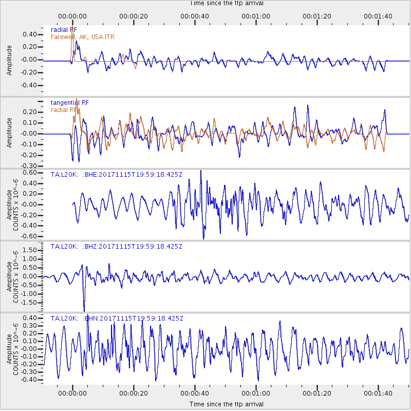
Signal To Noise
| Channel | StoN | STA | LTA |
| TA:L20K: :BHZ:20171115T19:59:18.425Z | 4.229516 | 6.0644095E-7 | 1.4338306E-7 |
| TA:L20K: :BHN:20171115T19:59:18.425Z | 0.8953448 | 1.6756945E-7 | 1.8715633E-7 |
| TA:L20K: :BHE:20171115T19:59:18.425Z | 1.4503284 | 2.01598E-7 | 1.3900163E-7 |
| Arrivals |
| Ps | |
| PpPs | |
| PsPs/PpSs | |


