You are here: Home > Network List > CI - Caltech Regional Seismic Network Stations List
> Station SMM Simmler, CA, USA > Earthquake Result Viewer
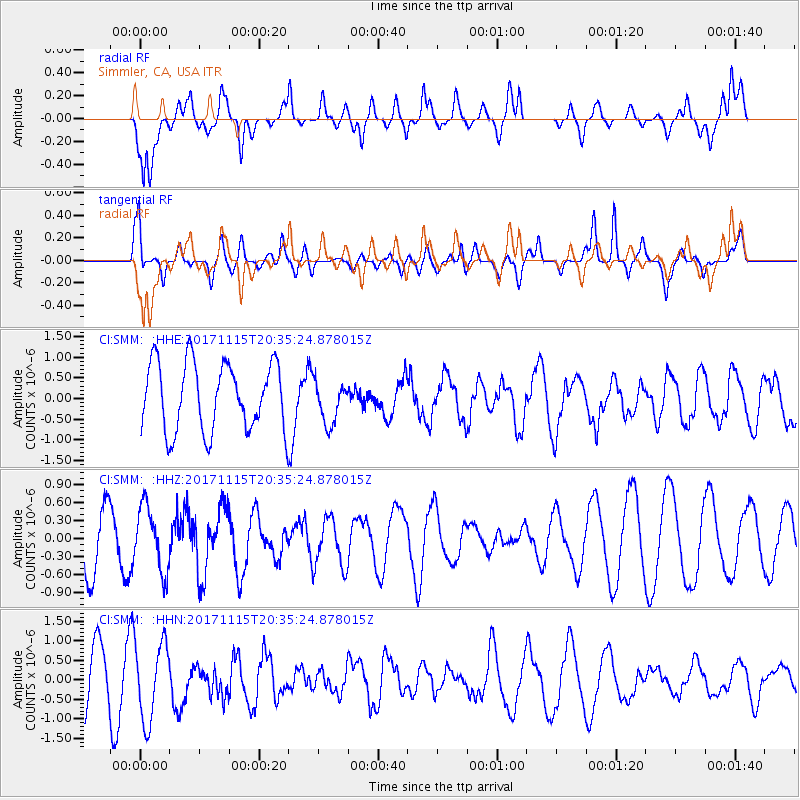
SMM Simmler, CA, USA - Earthquake Result Viewer
*The percent match for this event was below the threshold and hence no stack was calculated.
| Earthquake location: |
Loyalty Islands |
| Earthquake latitude/longitude: |
-22.0/168.9 |
| Earthquake time(UTC): |
2017/11/15 (319) 20:23:05 GMT |
| Earthquake Depth: |
8.0 km |
| Earthquake Magnitude: |
5.4 Mww |
| Earthquake Catalog/Contributor: |
NEIC PDE/us |
|
| Network: |
CI Caltech Regional Seismic Network |
| Station: |
SMM Simmler, CA, USA |
| Lat/Lon: |
35.31 N/120.00 W |
| Elevation: |
599 m |
|
| Distance: |
88.2 deg |
| Az: |
50.739 deg |
| Baz: |
241.514 deg |
| Ray Param: |
$rayparam |
*The percent match for this event was below the threshold and hence was not used in the summary stack. |
|
| Radial Match: |
69.94682 % |
| Radial Bump: |
400 |
| Transverse Match: |
40.014126 % |
| Transverse Bump: |
400 |
| SOD ConfigId: |
13570011 |
| Insert Time: |
2019-04-29 05:41:10.497 +0000 |
| GWidth: |
2.5 |
| Max Bumps: |
400 |
| Tol: |
0.001 |
|
Signal To Noise
| Channel | StoN | STA | LTA |
| CI:SMM: :HHZ:20171115T20:35:24.878015Z | 1.2095429 | 5.2930704E-7 | 4.3760915E-7 |
| CI:SMM: :HHN:20171115T20:35:24.878015Z | 1.1066296 | 9.755269E-7 | 8.8152973E-7 |
| CI:SMM: :HHE:20171115T20:35:24.878015Z | 0.545281 | 4.6682317E-7 | 8.5611487E-7 |
| Arrivals |
| Ps | |
| PpPs | |
| PsPs/PpSs | |


