You are here: Home > Network List > TA - USArray Transportable Network (new EarthScope stations) Stations List
> Station Q17K Contact Creek, Katmai, AK, USA > Earthquake Result Viewer
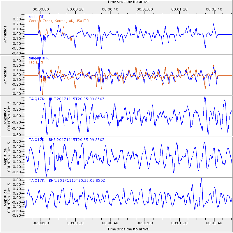
Q17K Contact Creek, Katmai, AK, USA - Earthquake Result Viewer
*The percent match for this event was below the threshold and hence no stack was calculated.
| Earthquake location: |
Loyalty Islands |
| Earthquake latitude/longitude: |
-22.0/168.9 |
| Earthquake time(UTC): |
2017/11/15 (319) 20:23:05 GMT |
| Earthquake Depth: |
8.0 km |
| Earthquake Magnitude: |
5.4 Mww |
| Earthquake Catalog/Contributor: |
NEIC PDE/us |
|
| Network: |
TA USArray Transportable Network (new EarthScope stations) |
| Station: |
Q17K Contact Creek, Katmai, AK, USA |
| Lat/Lon: |
58.26 N/155.89 W |
| Elevation: |
1165 m |
|
| Distance: |
85.1 deg |
| Az: |
17.826 deg |
| Baz: |
212.526 deg |
| Ray Param: |
$rayparam |
*The percent match for this event was below the threshold and hence was not used in the summary stack. |
|
| Radial Match: |
52.52227 % |
| Radial Bump: |
400 |
| Transverse Match: |
43.000996 % |
| Transverse Bump: |
400 |
| SOD ConfigId: |
13570011 |
| Insert Time: |
2019-04-29 05:42:57.969 +0000 |
| GWidth: |
2.5 |
| Max Bumps: |
400 |
| Tol: |
0.001 |
|
Signal To Noise
| Channel | StoN | STA | LTA |
| TA:Q17K: :BHZ:20171115T20:35:09.850Z | 2.7148952 | 5.0559595E-7 | 1.8623037E-7 |
| TA:Q17K: :BHN:20171115T20:35:09.850Z | 1.1219875 | 2.1682484E-7 | 1.9325068E-7 |
| TA:Q17K: :BHE:20171115T20:35:09.850Z | 0.37508294 | 1.0072356E-7 | 2.6853678E-7 |
| Arrivals |
| Ps | |
| PpPs | |
| PsPs/PpSs | |


