You are here: Home > Network List > TA - USArray Transportable Network (new EarthScope stations) Stations List
> Station M11K Mekoryuk, AK, USA > Earthquake Result Viewer
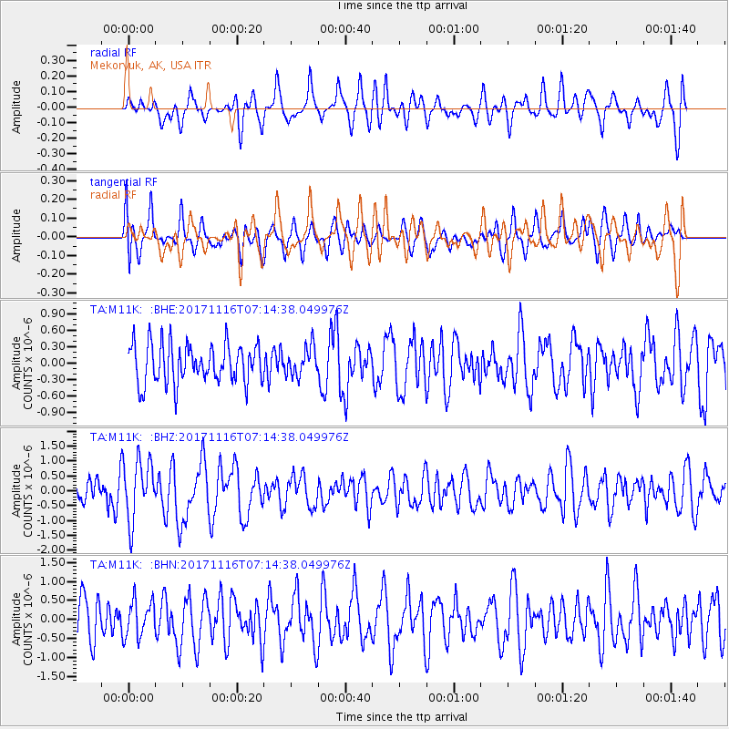
M11K Mekoryuk, AK, USA - Earthquake Result Viewer
*The percent match for this event was below the threshold and hence no stack was calculated.
| Earthquake location: |
Loyalty Islands |
| Earthquake latitude/longitude: |
-21.5/168.5 |
| Earthquake time(UTC): |
2017/11/16 (320) 07:02:38 GMT |
| Earthquake Depth: |
10 km |
| Earthquake Magnitude: |
5.9 Mww |
| Earthquake Catalog/Contributor: |
NEIC PDE/us |
|
| Network: |
TA USArray Transportable Network (new EarthScope stations) |
| Station: |
M11K Mekoryuk, AK, USA |
| Lat/Lon: |
60.38 N/166.20 W |
| Elevation: |
3.0 m |
|
| Distance: |
84.2 deg |
| Az: |
12.327 deg |
| Baz: |
203.593 deg |
| Ray Param: |
$rayparam |
*The percent match for this event was below the threshold and hence was not used in the summary stack. |
|
| Radial Match: |
59.125828 % |
| Radial Bump: |
400 |
| Transverse Match: |
59.72493 % |
| Transverse Bump: |
400 |
| SOD ConfigId: |
13570011 |
| Insert Time: |
2019-04-29 05:52:55.100 +0000 |
| GWidth: |
2.5 |
| Max Bumps: |
400 |
| Tol: |
0.001 |
|
Signal To Noise
| Channel | StoN | STA | LTA |
| TA:M11K: :BHZ:20171116T07:14:38.049976Z | 2.6965268 | 1.0239971E-6 | 3.7974667E-7 |
| TA:M11K: :BHN:20171116T07:14:38.049976Z | 0.7759026 | 4.8052635E-7 | 6.1931274E-7 |
| TA:M11K: :BHE:20171116T07:14:38.049976Z | 0.7311251 | 2.624407E-7 | 3.5895457E-7 |
| Arrivals |
| Ps | |
| PpPs | |
| PsPs/PpSs | |


