You are here: Home > Network List > TA - USArray Transportable Network (new EarthScope stations) Stations List
> Station R32K Eaglecrest, AK, USA > Earthquake Result Viewer
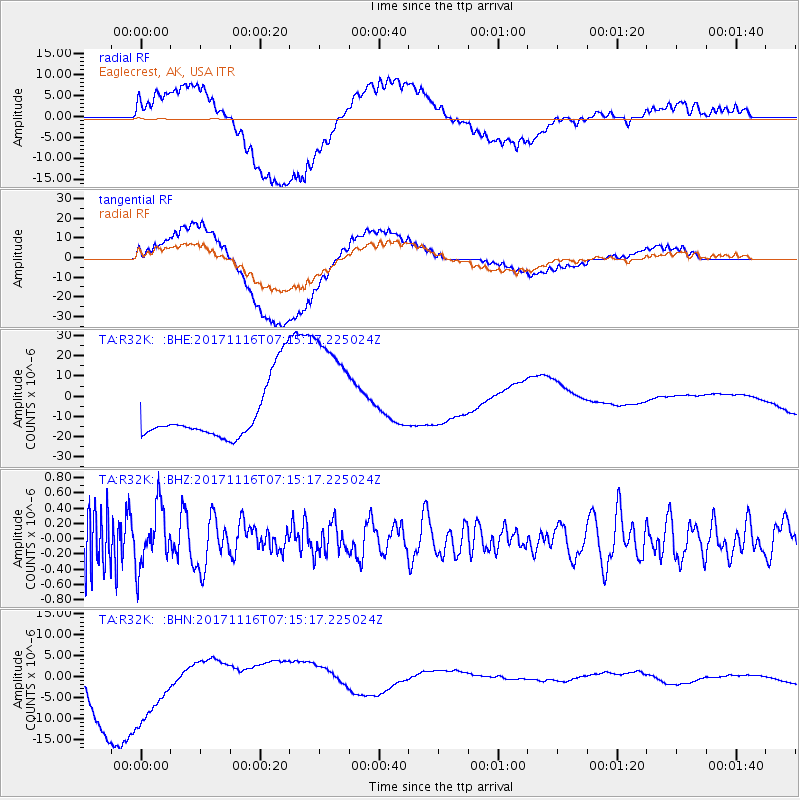
R32K Eaglecrest, AK, USA - Earthquake Result Viewer
*The percent match for this event was below the threshold and hence no stack was calculated.
| Earthquake location: |
Loyalty Islands |
| Earthquake latitude/longitude: |
-21.5/168.5 |
| Earthquake time(UTC): |
2017/11/16 (320) 07:02:38 GMT |
| Earthquake Depth: |
10 km |
| Earthquake Magnitude: |
5.9 Mww |
| Earthquake Catalog/Contributor: |
NEIC PDE/us |
|
| Network: |
TA USArray Transportable Network (new EarthScope stations) |
| Station: |
R32K Eaglecrest, AK, USA |
| Lat/Lon: |
58.27 N/134.52 W |
| Elevation: |
386 m |
|
| Distance: |
92.4 deg |
| Az: |
26.33 deg |
| Baz: |
231.406 deg |
| Ray Param: |
$rayparam |
*The percent match for this event was below the threshold and hence was not used in the summary stack. |
|
| Radial Match: |
51.929672 % |
| Radial Bump: |
400 |
| Transverse Match: |
66.41599 % |
| Transverse Bump: |
400 |
| SOD ConfigId: |
13570011 |
| Insert Time: |
2019-04-29 05:53:20.098 +0000 |
| GWidth: |
2.5 |
| Max Bumps: |
400 |
| Tol: |
0.001 |
|
Signal To Noise
| Channel | StoN | STA | LTA |
| TA:R32K: :BHZ:20171116T07:15:17.225024Z | 1.2483047 | 3.8856498E-7 | 3.1127414E-7 |
| TA:R32K: :BHN:20171116T07:15:17.225024Z | 1.5752063 | 1.1468833E-5 | 7.2808457E-6 |
| TA:R32K: :BHE:20171116T07:15:17.225024Z | 2.1611571 | 3.0757816E-5 | 1.4232104E-5 |
| Arrivals |
| Ps | |
| PpPs | |
| PsPs/PpSs | |


