You are here: Home > Network List > TA - USArray Transportable Network (new EarthScope stations) Stations List
> Station 115A Sonoran Desert, Stanfield, AZ, USA > Earthquake Result Viewer
115A Sonoran Desert, Stanfield, AZ, USA - Earthquake Result Viewer

| Earthquake location: |
Kuril Islands |
| Earthquake latitude/longitude: |
46.3/153.3 |
| Earthquake time(UTC): |
2006/10/13 (286) 13:47:39 GMT |
| Earthquake Depth: |
8.0 km |
| Earthquake Magnitude: |
5.5 MB, 5.8 MS, 6.3 MW, 5.8 MW |
| Earthquake Catalog/Contributor: |
WHDF/NEIC |
|
| Network: |
TA USArray Transportable Network (new EarthScope stations) |
| Station: |
115A Sonoran Desert, Stanfield, AZ, USA |
| Lat/Lon: |
32.70 N/112.23 W |
| Elevation: |
606 m |
|
| Distance: |
70.0 deg |
| Az: |
63.414 deg |
| Baz: |
312.61 deg |
| Ray Param: |
0.05524961 |
| Estimated Moho Depth: |
27.5 km |
| Estimated Crust Vp/Vs: |
1.75 |
| Assumed Crust Vp: |
6.264 km/s |
| Estimated Crust Vs: |
3.579 km/s |
| Estimated Crust Poisson's Ratio: |
0.26 |
|
| Radial Match: |
84.58251 % |
| Radial Bump: |
400 |
| Transverse Match: |
64.05238 % |
| Transverse Bump: |
400 |
| SOD ConfigId: |
2665 |
| Insert Time: |
2010-03-06 06:35:56.533 +0000 |
| GWidth: |
2.5 |
| Max Bumps: |
400 |
| Tol: |
0.001 |
|
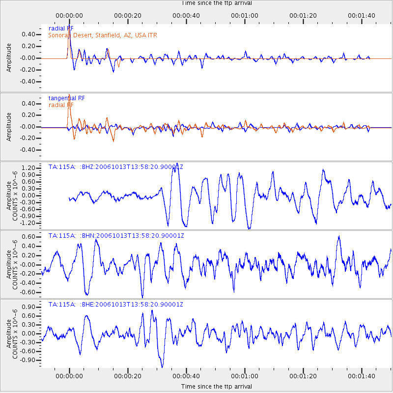
Signal To Noise
| Channel | StoN | STA | LTA |
| TA:115A: :BHN:20061013T13:58:20.90001Z | 2.2028098 | 2.7900987E-7 | 1.2666091E-7 |
| TA:115A: :BHE:20061013T13:58:20.90001Z | 2.269559 | 2.9785238E-7 | 1.31238E-7 |
| TA:115A: :BHZ:20061013T13:58:20.90001Z | 4.1054506 | 5.2903954E-7 | 1.2886272E-7 |
| Arrivals |
| Ps | 3.4 SECOND |
| PpPs | 12 SECOND |
| PsPs/PpSs | 15 SECOND |


