You are here: Home > Network List > AZ - ANZA Regional Network Stations List
> Station SMER AZ.SMER > Earthquake Result Viewer
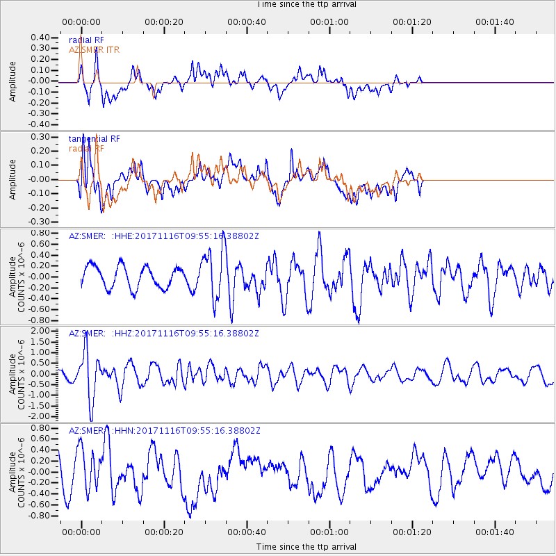
SMER AZ.SMER - Earthquake Result Viewer
*The percent match for this event was below the threshold and hence no stack was calculated.
| Earthquake location: |
Southeast Of Honshu, Japan |
| Earthquake latitude/longitude: |
32.2/140.5 |
| Earthquake time(UTC): |
2017/11/16 (320) 09:43:35 GMT |
| Earthquake Depth: |
71 km |
| Earthquake Magnitude: |
5.8 Mww |
| Earthquake Catalog/Contributor: |
NEIC PDE/us |
|
| Network: |
AZ ANZA Regional Network |
| Station: |
SMER AZ.SMER |
| Lat/Lon: |
33.46 N/117.17 W |
| Elevation: |
355 m |
|
| Distance: |
81.9 deg |
| Az: |
55.588 deg |
| Baz: |
303.199 deg |
| Ray Param: |
$rayparam |
*The percent match for this event was below the threshold and hence was not used in the summary stack. |
|
| Radial Match: |
68.432274 % |
| Radial Bump: |
400 |
| Transverse Match: |
63.478195 % |
| Transverse Bump: |
400 |
| SOD ConfigId: |
13570011 |
| Insert Time: |
2019-04-29 05:56:30.242 +0000 |
| GWidth: |
2.5 |
| Max Bumps: |
400 |
| Tol: |
0.001 |
|
Signal To Noise
| Channel | StoN | STA | LTA |
| AZ:SMER: :HHZ:20171116T09:55:16.38802Z | 6.430918 | 1.1639299E-6 | 1.809897E-7 |
| AZ:SMER: :HHN:20171116T09:55:16.38802Z | 0.9223089 | 3.5486758E-7 | 3.8476E-7 |
| AZ:SMER: :HHE:20171116T09:55:16.38802Z | 2.4064333 | 4.6745993E-7 | 1.9425426E-7 |
| Arrivals |
| Ps | |
| PpPs | |
| PsPs/PpSs | |


