You are here: Home > Network List > CH - Switzerland Seismological Network Stations List
> Station SENIN Lac Selin/Sanetsch > Earthquake Result Viewer
SENIN Lac Selin/Sanetsch - Earthquake Result Viewer
*The percent match for this event was below the threshold and hence no stack was calculated.
| Earthquake location: |
Southeast Of Honshu, Japan |
| Earthquake latitude/longitude: |
32.2/140.5 |
| Earthquake time(UTC): |
2017/11/16 (320) 09:43:35 GMT |
| Earthquake Depth: |
71 km |
| Earthquake Magnitude: |
5.8 Mww |
| Earthquake Catalog/Contributor: |
NEIC PDE/us |
|
| Network: |
CH Switzerland Seismological Network |
| Station: |
SENIN Lac Selin/Sanetsch |
| Lat/Lon: |
46.36 N/7.30 E |
| Elevation: |
2035 m |
|
| Distance: |
91.1 deg |
| Az: |
329.7 deg |
| Baz: |
38.152 deg |
| Ray Param: |
$rayparam |
*The percent match for this event was below the threshold and hence was not used in the summary stack. |
|
| Radial Match: |
47.71301 % |
| Radial Bump: |
324 |
| Transverse Match: |
65.210754 % |
| Transverse Bump: |
400 |
| SOD ConfigId: |
13570011 |
| Insert Time: |
2019-04-29 05:57:27.912 +0000 |
| GWidth: |
2.5 |
| Max Bumps: |
400 |
| Tol: |
0.001 |
|
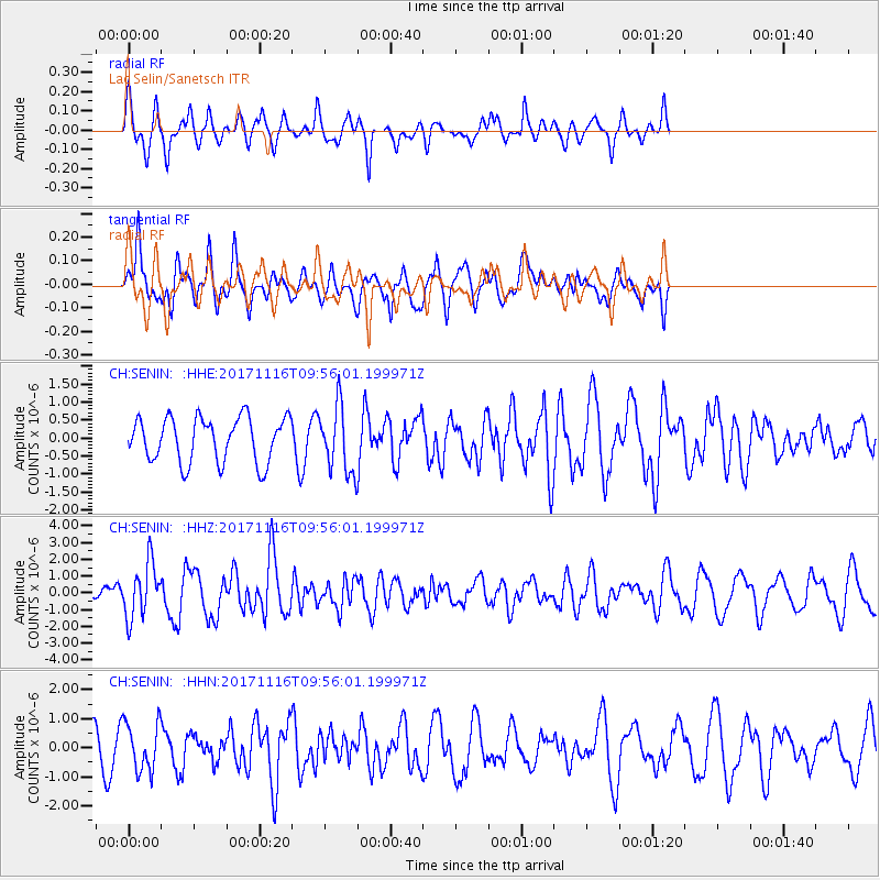
Signal To Noise
| Channel | StoN | STA | LTA |
| CH:SENIN: :HHZ:20171116T09:56:01.199971Z | 3.630448 | 1.6095129E-6 | 4.4333726E-7 |
| CH:SENIN: :HHN:20171116T09:56:01.199971Z | 1.6322564 | 8.311336E-7 | 5.0919306E-7 |
| CH:SENIN: :HHE:20171116T09:56:01.199971Z | 1.4724183 | 9.086518E-7 | 6.171153E-7 |
| Arrivals |
| Ps | |
| PpPs | |
| PsPs/PpSs | |


