You are here: Home > Network List > CI - Caltech Regional Seismic Network Stations List
> Station SMM Simmler, CA, USA > Earthquake Result Viewer
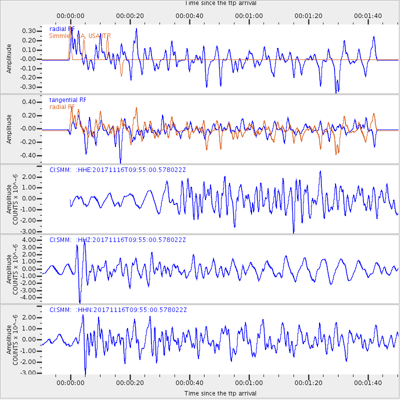
SMM Simmler, CA, USA - Earthquake Result Viewer
*The percent match for this event was below the threshold and hence no stack was calculated.
| Earthquake location: |
Southeast Of Honshu, Japan |
| Earthquake latitude/longitude: |
32.2/140.5 |
| Earthquake time(UTC): |
2017/11/16 (320) 09:43:35 GMT |
| Earthquake Depth: |
71 km |
| Earthquake Magnitude: |
5.8 Mww |
| Earthquake Catalog/Contributor: |
NEIC PDE/us |
|
| Network: |
CI Caltech Regional Seismic Network |
| Station: |
SMM Simmler, CA, USA |
| Lat/Lon: |
35.31 N/120.00 W |
| Elevation: |
599 m |
|
| Distance: |
79.0 deg |
| Az: |
55.271 deg |
| Baz: |
301.558 deg |
| Ray Param: |
$rayparam |
*The percent match for this event was below the threshold and hence was not used in the summary stack. |
|
| Radial Match: |
64.37542 % |
| Radial Bump: |
400 |
| Transverse Match: |
57.937 % |
| Transverse Bump: |
400 |
| SOD ConfigId: |
13570011 |
| Insert Time: |
2019-04-29 05:58:06.410 +0000 |
| GWidth: |
2.5 |
| Max Bumps: |
400 |
| Tol: |
0.001 |
|
Signal To Noise
| Channel | StoN | STA | LTA |
| CI:SMM: :HHZ:20171116T09:55:00.578022Z | 3.3590136 | 2.1945973E-6 | 6.5334575E-7 |
| CI:SMM: :HHN:20171116T09:55:00.578022Z | 1.1067567 | 9.0443547E-7 | 8.171945E-7 |
| CI:SMM: :HHE:20171116T09:55:00.578022Z | 2.3204396 | 8.8603565E-7 | 3.8183956E-7 |
| Arrivals |
| Ps | |
| PpPs | |
| PsPs/PpSs | |


