You are here: Home > Network List > TA - USArray Transportable Network (new EarthScope stations) Stations List
> Station F21K Alatna River, AK, USA > Earthquake Result Viewer
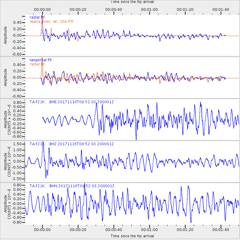
F21K Alatna River, AK, USA - Earthquake Result Viewer
*The percent match for this event was below the threshold and hence no stack was calculated.
| Earthquake location: |
Southeast Of Honshu, Japan |
| Earthquake latitude/longitude: |
32.2/140.5 |
| Earthquake time(UTC): |
2017/11/16 (320) 09:43:35 GMT |
| Earthquake Depth: |
71 km |
| Earthquake Magnitude: |
5.8 Mww |
| Earthquake Catalog/Contributor: |
NEIC PDE/us |
|
| Network: |
TA USArray Transportable Network (new EarthScope stations) |
| Station: |
F21K Alatna River, AK, USA |
| Lat/Lon: |
67.22 N/153.48 W |
| Elevation: |
597 m |
|
| Distance: |
51.5 deg |
| Az: |
27.033 deg |
| Baz: |
261.798 deg |
| Ray Param: |
$rayparam |
*The percent match for this event was below the threshold and hence was not used in the summary stack. |
|
| Radial Match: |
68.558464 % |
| Radial Bump: |
400 |
| Transverse Match: |
61.611557 % |
| Transverse Bump: |
400 |
| SOD ConfigId: |
13570011 |
| Insert Time: |
2019-04-29 06:03:43.997 +0000 |
| GWidth: |
2.5 |
| Max Bumps: |
400 |
| Tol: |
0.001 |
|
Signal To Noise
| Channel | StoN | STA | LTA |
| TA:F21K: :BHZ:20171116T09:52:03.200001Z | 4.712278 | 8.642938E-7 | 1.8341315E-7 |
| TA:F21K: :BHN:20171116T09:52:03.200001Z | 1.0969195 | 2.587531E-7 | 2.3589065E-7 |
| TA:F21K: :BHE:20171116T09:52:03.200001Z | 3.380409 | 4.2726344E-7 | 1.2639401E-7 |
| Arrivals |
| Ps | |
| PpPs | |
| PsPs/PpSs | |


