You are here: Home > Network List > TA - USArray Transportable Network (new EarthScope stations) Stations List
> Station I23K Minto, Yukon-Koyukuk, AK, USA > Earthquake Result Viewer
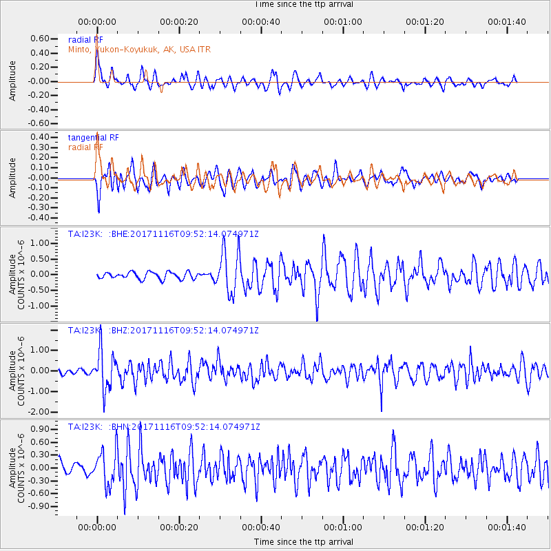
I23K Minto, Yukon-Koyukuk, AK, USA - Earthquake Result Viewer
*The percent match for this event was below the threshold and hence no stack was calculated.
| Earthquake location: |
Southeast Of Honshu, Japan |
| Earthquake latitude/longitude: |
32.2/140.5 |
| Earthquake time(UTC): |
2017/11/16 (320) 09:43:35 GMT |
| Earthquake Depth: |
71 km |
| Earthquake Magnitude: |
5.8 Mww |
| Earthquake Catalog/Contributor: |
NEIC PDE/us |
|
| Network: |
TA USArray Transportable Network (new EarthScope stations) |
| Station: |
I23K Minto, Yukon-Koyukuk, AK, USA |
| Lat/Lon: |
65.15 N/149.36 W |
| Elevation: |
149 m |
|
| Distance: |
53.0 deg |
| Az: |
29.857 deg |
| Baz: |
267.297 deg |
| Ray Param: |
$rayparam |
*The percent match for this event was below the threshold and hence was not used in the summary stack. |
|
| Radial Match: |
62.571064 % |
| Radial Bump: |
377 |
| Transverse Match: |
61.492046 % |
| Transverse Bump: |
400 |
| SOD ConfigId: |
13570011 |
| Insert Time: |
2019-04-29 06:04:16.089 +0000 |
| GWidth: |
2.5 |
| Max Bumps: |
400 |
| Tol: |
0.001 |
|
Signal To Noise
| Channel | StoN | STA | LTA |
| TA:I23K: :BHZ:20171116T09:52:14.074971Z | 8.231436 | 9.741358E-7 | 1.1834337E-7 |
| TA:I23K: :BHN:20171116T09:52:14.074971Z | 3.4842465 | 4.1575424E-7 | 1.19324E-7 |
| TA:I23K: :BHE:20171116T09:52:14.074971Z | 6.4615283 | 7.0473124E-7 | 1.0906572E-7 |
| Arrivals |
| Ps | |
| PpPs | |
| PsPs/PpSs | |


