You are here: Home > Network List > TA - USArray Transportable Network (new EarthScope stations) Stations List
> Station K22A Casper, WY, USA > Earthquake Result Viewer
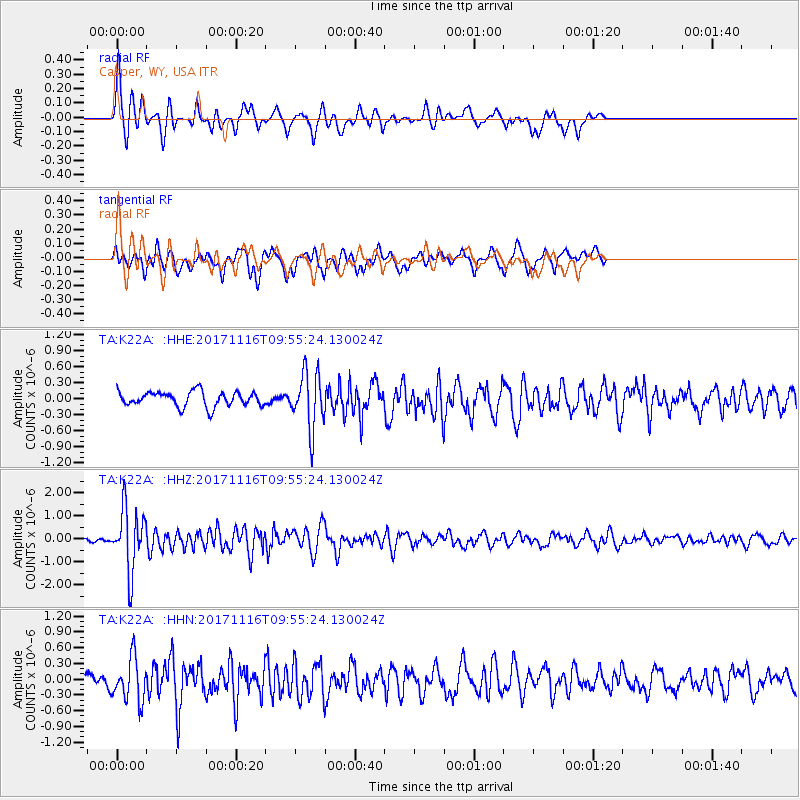
K22A Casper, WY, USA - Earthquake Result Viewer
*The percent match for this event was below the threshold and hence no stack was calculated.
| Earthquake location: |
Southeast Of Honshu, Japan |
| Earthquake latitude/longitude: |
32.2/140.5 |
| Earthquake time(UTC): |
2017/11/16 (320) 09:43:35 GMT |
| Earthquake Depth: |
71 km |
| Earthquake Magnitude: |
5.8 Mww |
| Earthquake Catalog/Contributor: |
NEIC PDE/us |
|
| Network: |
TA USArray Transportable Network (new EarthScope stations) |
| Station: |
K22A Casper, WY, USA |
| Lat/Lon: |
42.65 N/106.52 W |
| Elevation: |
1686 m |
|
| Distance: |
83.4 deg |
| Az: |
43.152 deg |
| Baz: |
308.18 deg |
| Ray Param: |
$rayparam |
*The percent match for this event was below the threshold and hence was not used in the summary stack. |
|
| Radial Match: |
73.65978 % |
| Radial Bump: |
314 |
| Transverse Match: |
57.986652 % |
| Transverse Bump: |
400 |
| SOD ConfigId: |
13570011 |
| Insert Time: |
2019-04-29 06:04:29.090 +0000 |
| GWidth: |
2.5 |
| Max Bumps: |
400 |
| Tol: |
0.001 |
|
Signal To Noise
| Channel | StoN | STA | LTA |
| TA:K22A: :HHZ:20171116T09:55:24.130024Z | 8.839155 | 1.340035E-6 | 1.5160217E-7 |
| TA:K22A: :HHN:20171116T09:55:24.130024Z | 2.1776927 | 4.1278457E-7 | 1.8955136E-7 |
| TA:K22A: :HHE:20171116T09:55:24.130024Z | 3.7563887 | 5.20827E-7 | 1.3865099E-7 |
| Arrivals |
| Ps | |
| PpPs | |
| PsPs/PpSs | |


