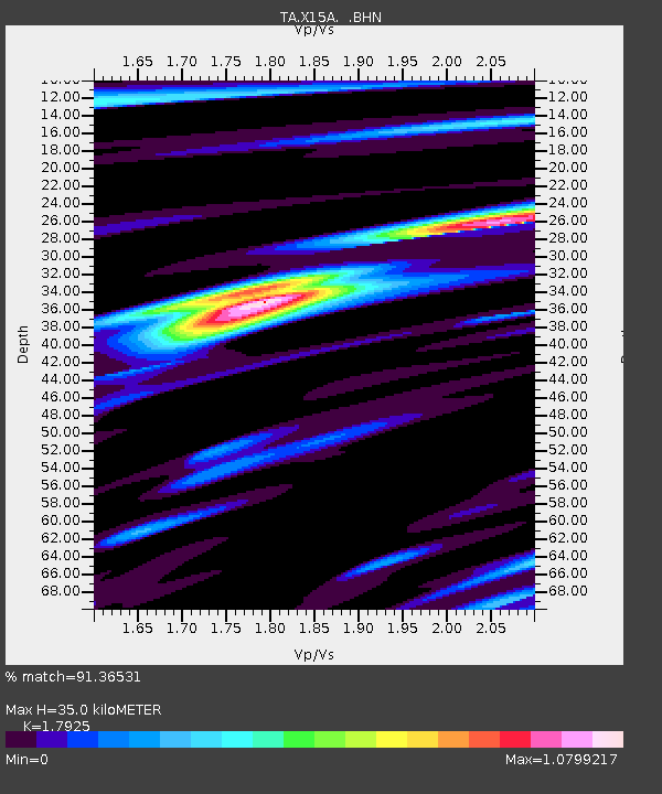
X15A Humboldt, AZ, USA - Earthquake Result Viewer
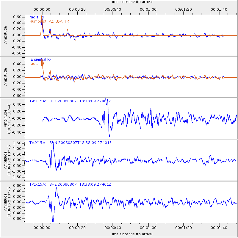
Earthquake location: Andreanof Islands, Aleutian Is.
Earthquake latitude/longitude: 52.2/-175.7
Earthquake time(UTC): 2008/08/07 (220) 18:30:03 GMT
Earthquake Depth: 12 km
Earthquake Magnitude: 5.6 MB, 5.5 MS, 5.8 MW, 5.8 MW
Earthquake Catalog/Contributor: WHDF/NEIC
Network: TA USArray Transportable Network (new EarthScope stations)
Station: X15A Humboldt, AZ, USA
Lat/Lon: 34.49 N/112.24 W
Elevation: 1332 m
Distance: 47.8 deg
Az: 85.691 deg
Baz: 311.998 deg
Ray Param: 0.069756806
Estimated Moho Depth: 35.0 km
Estimated Crust Vp/Vs: 1.79
Assumed Crust Vp: 6.276 km/s
Estimated Crust Vs: 3.501 km/s
Estimated Crust Poisson's Ratio: 0.27
Radial Match: 91.36531 %
Radial Bump: 338
Transverse Match: 71.136375 %
Transverse Bump: 400
SOD ConfigId: 2504
Insert Time: 2010-03-06 06:38:30.193 +0000
GWidth: 2.5
Max Bumps: 400
Tol: 0.001

Signal To Noise

ChannelStoNSTALTA
TA:X15A: :BHN:20080807T18:38:09.27401Z5.4637412.6528528E-74.8553783E-8
TA:X15A: :BHE:20080807T18:38:09.27401Z3.58428621.0413433E-72.9053018E-8
TA:X15A: :BHZ:20080807T18:38:09.27401Z2.86341331.06679984E-73.725623E-8
Arrivals
Ps4.7 SECOND
PpPs15 SECOND
PsPs/PpSs19 SECOND