You are here: Home > Network List > TA - USArray Transportable Network (new EarthScope stations) Stations List
> Station M24K Tolsona, Glennallen, AK, USA > Earthquake Result Viewer
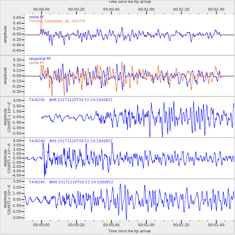
M24K Tolsona, Glennallen, AK, USA - Earthquake Result Viewer
*The percent match for this event was below the threshold and hence no stack was calculated.
| Earthquake location: |
Southeast Of Honshu, Japan |
| Earthquake latitude/longitude: |
32.2/140.5 |
| Earthquake time(UTC): |
2017/11/16 (320) 09:43:35 GMT |
| Earthquake Depth: |
71 km |
| Earthquake Magnitude: |
5.8 Mww |
| Earthquake Catalog/Contributor: |
NEIC PDE/us |
|
| Network: |
TA USArray Transportable Network (new EarthScope stations) |
| Station: |
M24K Tolsona, Glennallen, AK, USA |
| Lat/Lon: |
62.11 N/146.18 W |
| Elevation: |
908 m |
|
| Distance: |
54.4 deg |
| Az: |
33.651 deg |
| Baz: |
272.397 deg |
| Ray Param: |
$rayparam |
*The percent match for this event was below the threshold and hence was not used in the summary stack. |
|
| Radial Match: |
64.21925 % |
| Radial Bump: |
400 |
| Transverse Match: |
67.21536 % |
| Transverse Bump: |
400 |
| SOD ConfigId: |
13570011 |
| Insert Time: |
2019-04-29 06:04:48.739 +0000 |
| GWidth: |
2.5 |
| Max Bumps: |
400 |
| Tol: |
0.001 |
|
Signal To Noise
| Channel | StoN | STA | LTA |
| TA:M24K: :BHZ:20171116T09:52:24.399983Z | 6.7710705 | 2.0513048E-6 | 3.0295135E-7 |
| TA:M24K: :BHN:20171116T09:52:24.399983Z | 0.83033985 | 3.8945814E-7 | 4.690346E-7 |
| TA:M24K: :BHE:20171116T09:52:24.399983Z | 1.6695149 | 5.8066064E-7 | 3.47802E-7 |
| Arrivals |
| Ps | |
| PpPs | |
| PsPs/PpSs | |


