You are here: Home > Network List > TA - USArray Transportable Network (new EarthScope stations) Stations List
> Station MSTX Muleshoe, TX, USA > Earthquake Result Viewer
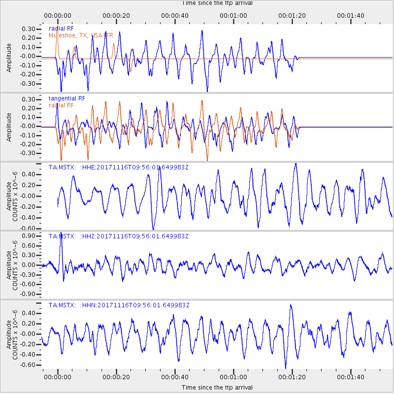
MSTX Muleshoe, TX, USA - Earthquake Result Viewer
*The percent match for this event was below the threshold and hence no stack was calculated.
| Earthquake location: |
Southeast Of Honshu, Japan |
| Earthquake latitude/longitude: |
32.2/140.5 |
| Earthquake time(UTC): |
2017/11/16 (320) 09:43:35 GMT |
| Earthquake Depth: |
71 km |
| Earthquake Magnitude: |
5.8 Mww |
| Earthquake Catalog/Contributor: |
NEIC PDE/us |
|
| Network: |
TA USArray Transportable Network (new EarthScope stations) |
| Station: |
MSTX Muleshoe, TX, USA |
| Lat/Lon: |
33.97 N/102.77 W |
| Elevation: |
1167 m |
|
| Distance: |
91.2 deg |
| Az: |
47.966 deg |
| Baz: |
310.727 deg |
| Ray Param: |
$rayparam |
*The percent match for this event was below the threshold and hence was not used in the summary stack. |
|
| Radial Match: |
45.37903 % |
| Radial Bump: |
327 |
| Transverse Match: |
46.577335 % |
| Transverse Bump: |
356 |
| SOD ConfigId: |
13570011 |
| Insert Time: |
2019-04-29 06:04:55.212 +0000 |
| GWidth: |
2.5 |
| Max Bumps: |
400 |
| Tol: |
0.001 |
|
Signal To Noise
| Channel | StoN | STA | LTA |
| TA:MSTX: :HHZ:20171116T09:56:01.649983Z | 2.251078 | 3.5488202E-7 | 1.5764981E-7 |
| TA:MSTX: :HHN:20171116T09:56:01.649983Z | 0.90257496 | 1.5603639E-7 | 1.7287914E-7 |
| TA:MSTX: :HHE:20171116T09:56:01.649983Z | 1.9385478 | 3.3979086E-7 | 1.7528113E-7 |
| Arrivals |
| Ps | |
| PpPs | |
| PsPs/PpSs | |


