You are here: Home > Network List > TA - USArray Transportable Network (new EarthScope stations) Stations List
> Station O28M Mount Upton, YT, CAN > Earthquake Result Viewer
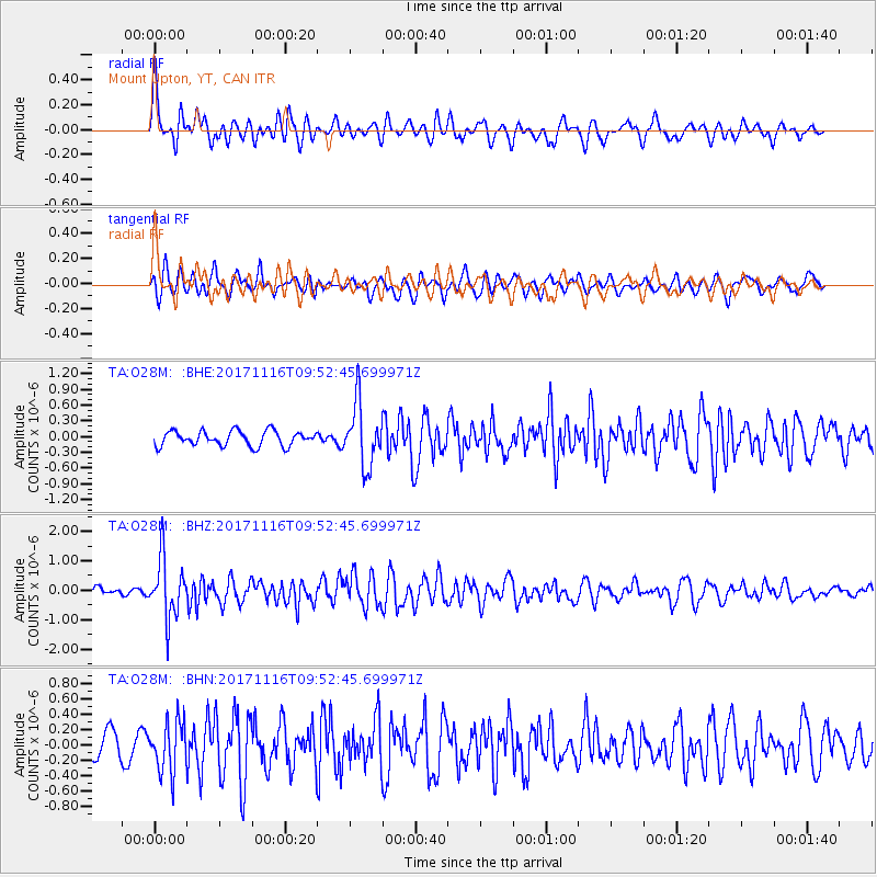
O28M Mount Upton, YT, CAN - Earthquake Result Viewer
*The percent match for this event was below the threshold and hence no stack was calculated.
| Earthquake location: |
Southeast Of Honshu, Japan |
| Earthquake latitude/longitude: |
32.2/140.5 |
| Earthquake time(UTC): |
2017/11/16 (320) 09:43:35 GMT |
| Earthquake Depth: |
71 km |
| Earthquake Magnitude: |
5.8 Mww |
| Earthquake Catalog/Contributor: |
NEIC PDE/us |
|
| Network: |
TA USArray Transportable Network (new EarthScope stations) |
| Station: |
O28M Mount Upton, YT, CAN |
| Lat/Lon: |
60.77 N/140.19 W |
| Elevation: |
2622 m |
|
| Distance: |
57.4 deg |
| Az: |
34.935 deg |
| Baz: |
278.367 deg |
| Ray Param: |
$rayparam |
*The percent match for this event was below the threshold and hence was not used in the summary stack. |
|
| Radial Match: |
76.94858 % |
| Radial Bump: |
400 |
| Transverse Match: |
73.26434 % |
| Transverse Bump: |
400 |
| SOD ConfigId: |
13570011 |
| Insert Time: |
2019-04-29 06:05:12.313 +0000 |
| GWidth: |
2.5 |
| Max Bumps: |
400 |
| Tol: |
0.001 |
|
Signal To Noise
| Channel | StoN | STA | LTA |
| TA:O28M: :BHZ:20171116T09:52:45.699971Z | 9.038158 | 1.0032613E-6 | 1.1100285E-7 |
| TA:O28M: :BHN:20171116T09:52:45.699971Z | 2.6820025 | 3.28677E-7 | 1.225491E-7 |
| TA:O28M: :BHE:20171116T09:52:45.699971Z | 4.2343845 | 5.9590127E-7 | 1.4072913E-7 |
| Arrivals |
| Ps | |
| PpPs | |
| PsPs/PpSs | |


