You are here: Home > Network List > TA - USArray Transportable Network (new EarthScope stations) Stations List
> Station P17K Kvichak River, AK, USA > Earthquake Result Viewer
P17K Kvichak River, AK, USA - Earthquake Result Viewer
*The percent match for this event was below the threshold and hence no stack was calculated.
| Earthquake location: |
Southeast Of Honshu, Japan |
| Earthquake latitude/longitude: |
32.2/140.5 |
| Earthquake time(UTC): |
2017/11/16 (320) 09:43:35 GMT |
| Earthquake Depth: |
71 km |
| Earthquake Magnitude: |
5.8 Mww |
| Earthquake Catalog/Contributor: |
NEIC PDE/us |
|
| Network: |
TA USArray Transportable Network (new EarthScope stations) |
| Station: |
P17K Kvichak River, AK, USA |
| Lat/Lon: |
59.20 N/156.44 W |
| Elevation: |
91 m |
|
| Distance: |
49.3 deg |
| Az: |
37.245 deg |
| Baz: |
265.68 deg |
| Ray Param: |
$rayparam |
*The percent match for this event was below the threshold and hence was not used in the summary stack. |
|
| Radial Match: |
70.609215 % |
| Radial Bump: |
400 |
| Transverse Match: |
66.35396 % |
| Transverse Bump: |
400 |
| SOD ConfigId: |
13570011 |
| Insert Time: |
2019-04-29 06:05:14.982 +0000 |
| GWidth: |
2.5 |
| Max Bumps: |
400 |
| Tol: |
0.001 |
|
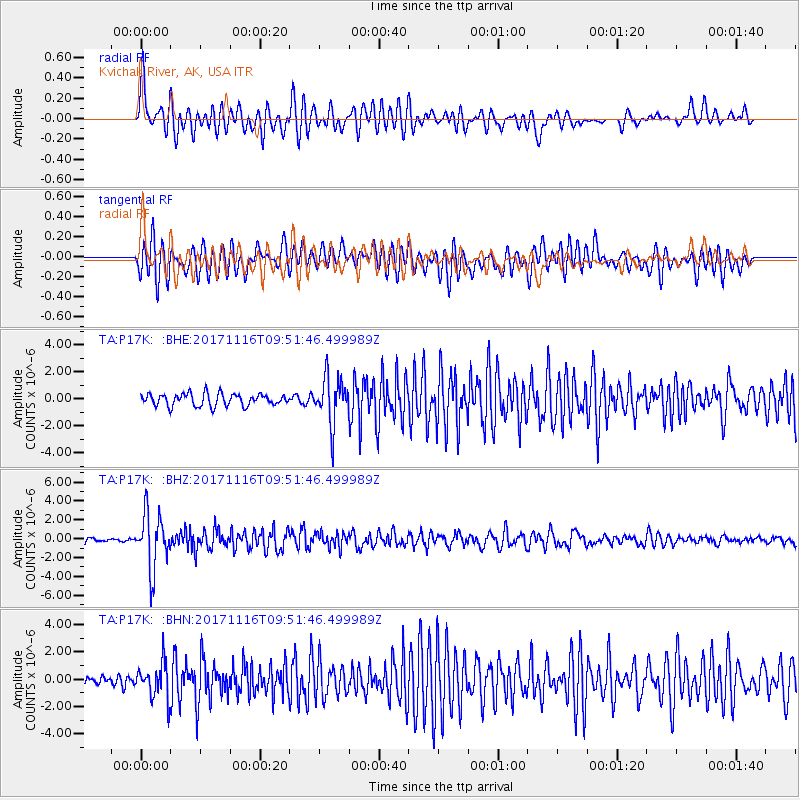
Signal To Noise
| Channel | StoN | STA | LTA |
| TA:P17K: :BHZ:20171116T09:51:46.499989Z | 13.447504 | 2.9520077E-6 | 2.1952086E-7 |
| TA:P17K: :BHN:20171116T09:51:46.499989Z | 2.632049 | 1.2805334E-6 | 4.865158E-7 |
| TA:P17K: :BHE:20171116T09:51:46.499989Z | 3.715259 | 1.6768153E-6 | 4.51332E-7 |
| Arrivals |
| Ps | |
| PpPs | |
| PsPs/PpSs | |


