You are here: Home > Network List > TA - USArray Transportable Network (new EarthScope stations) Stations List
> Station T35M Bob Quinn, BC, CAN > Earthquake Result Viewer
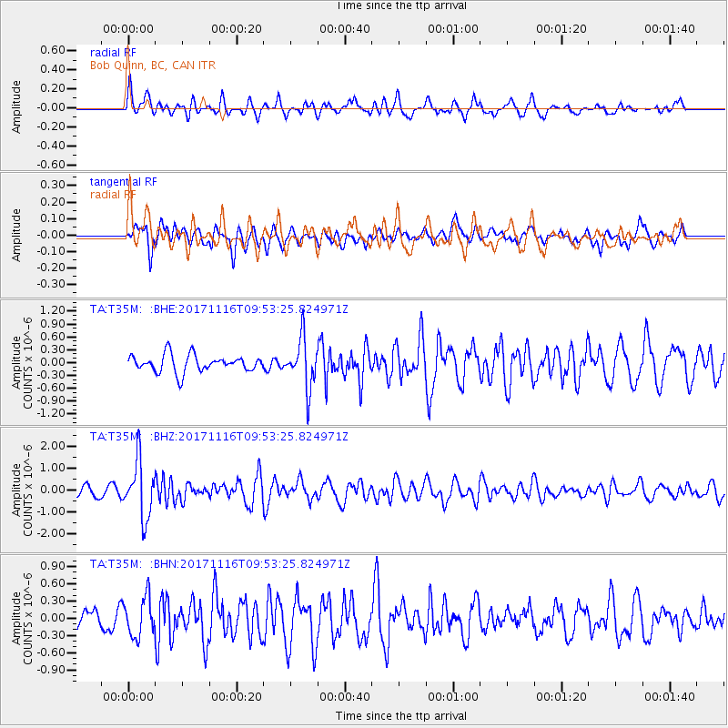
T35M Bob Quinn, BC, CAN - Earthquake Result Viewer
*The percent match for this event was below the threshold and hence no stack was calculated.
| Earthquake location: |
Southeast Of Honshu, Japan |
| Earthquake latitude/longitude: |
32.2/140.5 |
| Earthquake time(UTC): |
2017/11/16 (320) 09:43:35 GMT |
| Earthquake Depth: |
71 km |
| Earthquake Magnitude: |
5.8 Mww |
| Earthquake Catalog/Contributor: |
NEIC PDE/us |
|
| Network: |
TA USArray Transportable Network (new EarthScope stations) |
| Station: |
T35M Bob Quinn, BC, CAN |
| Lat/Lon: |
56.98 N/130.25 W |
| Elevation: |
609 m |
|
| Distance: |
63.3 deg |
| Az: |
37.809 deg |
| Baz: |
288.298 deg |
| Ray Param: |
$rayparam |
*The percent match for this event was below the threshold and hence was not used in the summary stack. |
|
| Radial Match: |
66.01734 % |
| Radial Bump: |
400 |
| Transverse Match: |
48.5425 % |
| Transverse Bump: |
400 |
| SOD ConfigId: |
13570011 |
| Insert Time: |
2019-04-29 06:05:39.042 +0000 |
| GWidth: |
2.5 |
| Max Bumps: |
400 |
| Tol: |
0.001 |
|
Signal To Noise
| Channel | StoN | STA | LTA |
| TA:T35M: :BHZ:20171116T09:53:25.824971Z | 4.463539 | 1.2919255E-6 | 2.8943973E-7 |
| TA:T35M: :BHN:20171116T09:53:25.824971Z | 1.5458548 | 3.401769E-7 | 2.2005747E-7 |
| TA:T35M: :BHE:20171116T09:53:25.824971Z | 2.883215 | 5.7326446E-7 | 1.988282E-7 |
| Arrivals |
| Ps | |
| PpPs | |
| PsPs/PpSs | |


