You are here: Home > Network List > UW - Pacific Northwest Regional Seismic Network Stations List
> Station IZEE Izee, OR, USA > Earthquake Result Viewer
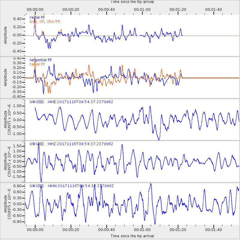
IZEE Izee, OR, USA - Earthquake Result Viewer
*The percent match for this event was below the threshold and hence no stack was calculated.
| Earthquake location: |
Southeast Of Honshu, Japan |
| Earthquake latitude/longitude: |
32.2/140.5 |
| Earthquake time(UTC): |
2017/11/16 (320) 09:43:35 GMT |
| Earthquake Depth: |
71 km |
| Earthquake Magnitude: |
5.8 Mww |
| Earthquake Catalog/Contributor: |
NEIC PDE/us |
|
| Network: |
UW Pacific Northwest Regional Seismic Network |
| Station: |
IZEE Izee, OR, USA |
| Lat/Lon: |
44.08 N/119.50 W |
| Elevation: |
1293 m |
|
| Distance: |
74.8 deg |
| Az: |
47.351 deg |
| Baz: |
300.072 deg |
| Ray Param: |
$rayparam |
*The percent match for this event was below the threshold and hence was not used in the summary stack. |
|
| Radial Match: |
57.81341 % |
| Radial Bump: |
400 |
| Transverse Match: |
57.96174 % |
| Transverse Bump: |
400 |
| SOD ConfigId: |
13570011 |
| Insert Time: |
2019-04-29 06:06:33.319 +0000 |
| GWidth: |
2.5 |
| Max Bumps: |
400 |
| Tol: |
0.001 |
|
Signal To Noise
| Channel | StoN | STA | LTA |
| UW:IZEE: :HHZ:20171116T09:54:37.237996Z | 1.7677807 | 9.664539E-7 | 5.4670465E-7 |
| UW:IZEE: :HHN:20171116T09:54:37.237996Z | 1.9305251 | 5.259498E-7 | 2.7243874E-7 |
| UW:IZEE: :HHE:20171116T09:54:37.237996Z | 1.4932746 | 6.016049E-7 | 4.0287628E-7 |
| Arrivals |
| Ps | |
| PpPs | |
| PsPs/PpSs | |


