You are here: Home > Network List > UW - Pacific Northwest Regional Seismic Network Stations List
> Station YACT Amboy, WA, USA > Earthquake Result Viewer
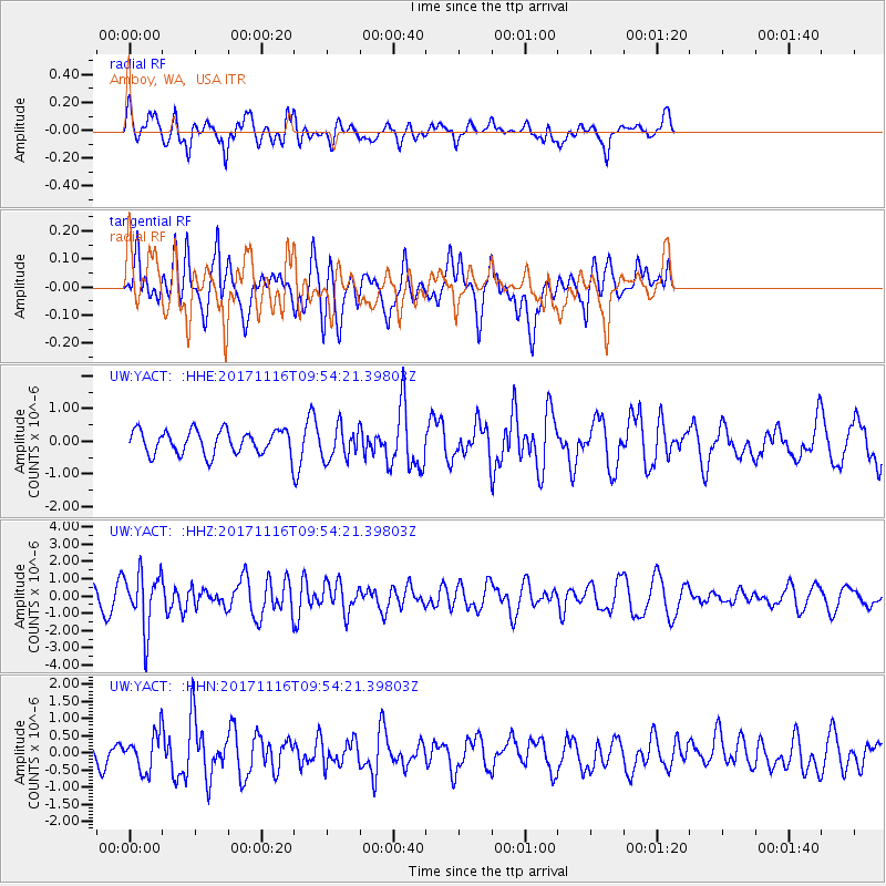
YACT Amboy, WA, USA - Earthquake Result Viewer
*The percent match for this event was below the threshold and hence no stack was calculated.
| Earthquake location: |
Southeast Of Honshu, Japan |
| Earthquake latitude/longitude: |
32.2/140.5 |
| Earthquake time(UTC): |
2017/11/16 (320) 09:43:35 GMT |
| Earthquake Depth: |
71 km |
| Earthquake Magnitude: |
5.8 Mww |
| Earthquake Catalog/Contributor: |
NEIC PDE/us |
|
| Network: |
UW Pacific Northwest Regional Seismic Network |
| Station: |
YACT Amboy, WA, USA |
| Lat/Lon: |
45.93 N/122.42 W |
| Elevation: |
211 m |
|
| Distance: |
72.1 deg |
| Az: |
46.707 deg |
| Baz: |
297.834 deg |
| Ray Param: |
$rayparam |
*The percent match for this event was below the threshold and hence was not used in the summary stack. |
|
| Radial Match: |
58.166164 % |
| Radial Bump: |
400 |
| Transverse Match: |
64.12023 % |
| Transverse Bump: |
400 |
| SOD ConfigId: |
13570011 |
| Insert Time: |
2019-04-29 06:06:50.880 +0000 |
| GWidth: |
2.5 |
| Max Bumps: |
400 |
| Tol: |
0.001 |
|
Signal To Noise
| Channel | StoN | STA | LTA |
| UW:YACT: :HHZ:20171116T09:54:21.39803Z | 3.8316383 | 1.6169656E-6 | 4.2200372E-7 |
| UW:YACT: :HHN:20171116T09:54:21.39803Z | 1.3539803 | 5.195425E-7 | 3.83715E-7 |
| UW:YACT: :HHE:20171116T09:54:21.39803Z | 1.3773402 | 4.9662566E-7 | 3.6056863E-7 |
| Arrivals |
| Ps | |
| PpPs | |
| PsPs/PpSs | |


