
X15A Humboldt, AZ, USA - Earthquake Result Viewer
| ||||||||||||||||||
| ||||||||||||||||||
| ||||||||||||||||||
|

Signal To Noise
| Channel | StoN | STA | LTA |
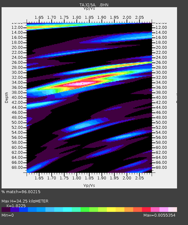
| TA:X15A: :BHN:20070716T01:25:15.025029Z | 16.211329 | 3.9711858E-7 | 2.4496364E-8 |
| TA:X15A: :BHE:20070716T01:25:15.025029Z | 13.650612 | 3.5456748E-7 | 2.5974474E-8 |
| TA:X15A: :BHZ:20070716T01:25:15.025029Z | 49.582176 | 1.8583688E-6 | 3.7480582E-8 |
| Arrivals | |
| Ps | 4.6 SECOND |
| PpPs | 15 SECOND |
| PsPs/PpSs | 20 SECOND |

