You are here: Home > Network List > CN - Canadian National Seismograph Network Stations List
> Station INK INUVIK, NT > Earthquake Result Viewer
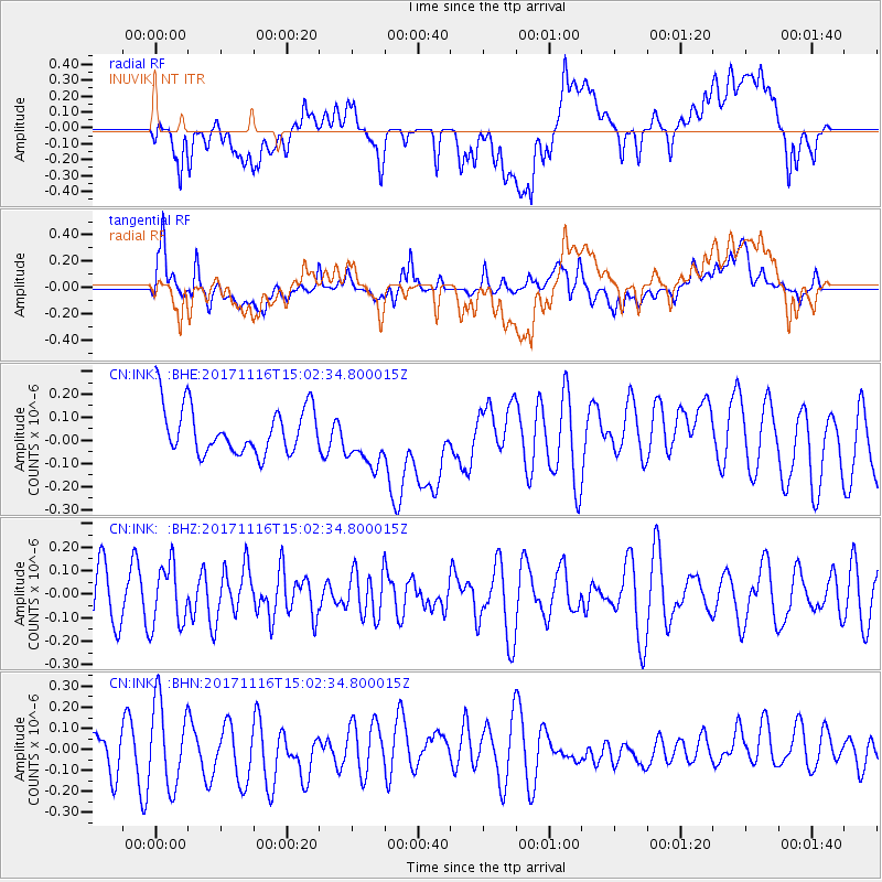
INK INUVIK, NT - Earthquake Result Viewer
*The percent match for this event was below the threshold and hence no stack was calculated.
| Earthquake location: |
Solomon Islands |
| Earthquake latitude/longitude: |
-10.1/160.9 |
| Earthquake time(UTC): |
2017/11/16 (320) 14:50:04 GMT |
| Earthquake Depth: |
10 km |
| Earthquake Magnitude: |
5.6 mb |
| Earthquake Catalog/Contributor: |
NEIC PDE/us |
|
| Network: |
CN Canadian National Seismograph Network |
| Station: |
INK INUVIK, NT |
| Lat/Lon: |
68.31 N/133.53 W |
| Elevation: |
44 m |
|
| Distance: |
90.6 deg |
| Az: |
19.782 deg |
| Baz: |
243.694 deg |
| Ray Param: |
$rayparam |
*The percent match for this event was below the threshold and hence was not used in the summary stack. |
|
| Radial Match: |
35.81852 % |
| Radial Bump: |
400 |
| Transverse Match: |
54.584717 % |
| Transverse Bump: |
400 |
| SOD ConfigId: |
13570011 |
| Insert Time: |
2019-04-29 06:09:47.307 +0000 |
| GWidth: |
2.5 |
| Max Bumps: |
400 |
| Tol: |
0.001 |
|
Signal To Noise
| Channel | StoN | STA | LTA |
| CN:INK: :BHZ:20171116T15:02:34.800015Z | 1.3288181 | 1.2899933E-7 | 9.707825E-8 |
| CN:INK: :BHN:20171116T15:02:34.800015Z | 2.0774925 | 1.9708874E-7 | 9.486856E-8 |
| CN:INK: :BHE:20171116T15:02:34.800015Z | 1.16125 | 1.1904077E-7 | 1.02510896E-7 |
| Arrivals |
| Ps | |
| PpPs | |
| PsPs/PpSs | |


